Makinsk geodata
Makinsk (Aqmola) is a populated place; located in Kazakhstan in Asia/Almaty (GMT+5) time zone. With population of 17,711 people, there are 72 cities with bigger population in this country. Compared to other cities in Kazakhstan, 88.1% of cities are located further ↓South; 50.7% of cities are located further ←West and 58.1% of cities have lower elevation than Makinsk. Note1


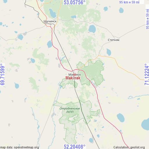
Makinsk GPS coordinates[2]
52° 37' 58.44" North, 70° 25' 8.796" East
| Map corner | latitude | longitude |
|---|---|---|
| Upper-left | 53.05756°, | 69.71599° |
| Center: | 52.6329°, | 70.41911° |
| Lower-right: | 52.20408°, | 71.12224° |
| Map W x H: | 94.9×94.9 km | = 59×59mi |
| max Lat: | 54.90596° ⇑11.9% North |
| Makinsk: | 52.6329° |
| min Lat: | ⇓88.1% South 40.66338° |
| min Long | Makinsk | max Long |
| 46.83361° | 70.41911° | 84.87144° |
| W 50.7%⇐ | ⇒49.3% E |
Elevation
Elevation of Makinsk is 380 m = 1247 ft, and this is 23.5 m = 77 ft above average elevation for this country.
| Max E: |
1847 m = 6060 ft | 41.9% |
| Makinsk | 380 m 1247 ft | |
| Avg. | 356.5 m = 1170 ft | |
Min E: |
-26 m = -85 ft | 58.1% |
See also: Kazakhstan elevation on elevation.city.
Geographical zone
Makinsk is located in North temperate zone (between Tropic of Cancer and the Arctic Circle). Distance of this North polar circle is 1548.9 km =962.4 mi to North.| Distance of | km | miles | from Makinsk |
|---|---|---|---|
| North Pole | 4154.8 | 2581.7 | to North |
| Arctic Circle | 1548.9 | 962.4 | to North |
| Tropic Cancer | 3246.3 | 2017.2 | to South |
| Equator | 5852.2 | 3636.4 | to South |


Nearby cities:
15 places around Makinsk: (largest is in red/bold)
• Akkol
79.6 km =49.5 mi,  153°
153°
• Akkol’
91.9 km =57.1 mi,  323°
323°
• Aksu
106.1 km =65.9 mi,  101°
101°
• Astrakhan
129.7 km =80.6 mi,  199°
199°
• Balkashino
113.4 km =70.5 mi,  263°
263°
• Būrabay
50.6 km =31.4 mi,  351°
351°
• Kokshetau
99.4 km =61.8 mi, 316°
• Shchuchinsk
37.1 km =23.1 mi,  335°
335°
• Shortandy
111 km =69 mi,  159°
159°
• Stepnogorsk
103.9 km =64.6 mi,  107°
107°
• Stepnyak
33.5 km =20.8 mi,  47°
47°
• Taiynsha
141.9 km =88.2 mi, 342°
• Talshik
148 km =92 mi,  40°
40°
• Zavodskoy
109.4 km =68 mi, 99°
• Zholymbet
132.6 km =82.4 mi,  138°
138°
Sources, notices
• [Note1] Compared only with cities in Kazakhstan existing in our database
• [Src1] Map data: © OpenStreetMap contributors (CC-BY-SA)
• [Src2] Other city data from geonames.org with taken over terms of usage.
• [Src3] Geographical zone / Annual Mean Temperature by Robert A. Rohde @ Wikipedia
