Shchuchinsk geodata
Shchuchinsk (Aqmola) is a seat of a second-order administrative division; located in Kazakhstan in Asia/Almaty (GMT+5) time zone. With population of 47,290 people, there are 29 cities with bigger population in this country. Compared to other cities in Kazakhstan, 90.4% of cities are located further ↓South; 51.1% of cities are located further →East and 62.6% of cities have lower elevation than Shchuchinsk. Note1


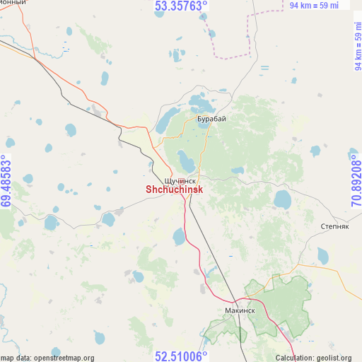
Shchuchinsk GPS coordinates[2]
52° 56' 9.312" North, 70° 11' 20.22" East
| Map corner | latitude | longitude |
|---|---|---|
| Upper-left | 53.35763°, | 69.48583° |
| Center: | 52.93592°, | 70.18895° |
| Lower-right: | 52.51006°, | 70.89208° |
| Map W x H: | 94.2×94.2 km | = 58.5×58.5mi |
| max Lat: | 54.90596° ⇑9.6% North |
| Shchuchinsk: | 52.93592° |
| min Lat: | ⇓90.4% South 40.66338° |
| min Long | Shchuchinsk | max Long |
| 46.83361° | 70.18895° | 84.87144° |
| W 48.9%⇐ | ⇒51.1% E |
Elevation
Elevation of Shchuchinsk is 405 m = 1329 ft, and this is 48.5 m = 159 ft above average elevation for this country.
| Max E: |
1847 m = 6060 ft | 37.4% |
| Shchuchinsk | 405 m 1329 ft | |
| Avg. | 356.5 m = 1170 ft | |
Min E: |
-26 m = -85 ft | 62.6% |
See also: Shchuchinsk elevation on elevation.city.
Geographical zone
Shchuchinsk is located in North temperate zone (between Tropic of Cancer and the Arctic Circle). Distance of this North polar circle is 1515.3 km =941.6 mi to North.| Distance of | km | miles | from Shchuchinsk |
|---|---|---|---|
| North Pole | 4121.1 | 2560.7 | to North |
| Arctic Circle | 1515.3 | 941.6 | to North |
| Tropic Cancer | 3280 | 2038.1 | to South |
| Equator | 5885.9 | 3657.3 | to South |


Nearby cities:
15 places around Shchuchinsk: (largest is in red/bold)
• Akkol
116.7 km =72.5 mi,  153°
153°
• Akkol’
56.1 km =34.9 mi,  315°
315°
• Aksu
131.1 km =81.5 mi,  114°
114°
• Balkashino
107.4 km =66.7 mi,  244°
244°
• Birlestik
141.7 km =88 mi,  300°
300°
• Būrabay
18.4 km =11.4 mi,  26°
26°
• Kokshetau
65.3 km =40.6 mi,  306°
306°
• Makinsk
37.1 km =23.1 mi,  155°
155°
• Shantobe
145.9 km =90.7 mi,  248°
248°
• Stepnogorsk
131.4 km =81.6 mi,  119°
119°
• Stepnyak
41.8 km =26 mi, 105°
• Taiynsha
105.2 km =65.4 mi,  344°
344°
• Talshik
136.5 km =84.8 mi,  55°
55°
• Volodarskoye
144.6 km =89.9 mi,  285°
285°
• Zavodskoy
133.5 km =83 mi, 112°
Sources, notices
• [Note1] Compared only with cities in Kazakhstan existing in our database
• [Src1] Map data: © OpenStreetMap contributors (CC-BY-SA)
• [Src2] Other city data from geonames.org with taken over terms of usage.
• [Src3] Geographical zone / Annual Mean Temperature by Robert A. Rohde @ Wikipedia
