Zholymbet geodata
Zholymbet (Aqmola) is a populated place; located in Kazakhstan in Asia/Almaty (GMT+5) time zone. With population of 6,876 people, there are 157 cities with bigger population in this country. Compared to other cities in Kazakhstan, 80.4% of cities are located further ↓South; 55.9% of cities are located further ←West and 50% of cities have lower elevation than Zholymbet. Note1


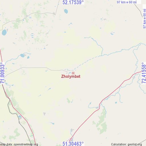
Zholymbet GPS coordinates[2]
51° 44' 31.596" North, 71° 42' 44.82" East
| Map corner | latitude | longitude |
|---|---|---|
| Upper-left | 52.17539°, | 71.00933° |
| Center: | 51.74211°, | 71.71245° |
| Lower-right: | 51.30463°, | 72.41558° |
| Map W x H: | 96.8×96.8 km | = 60.1×60.1mi |
| max Lat: | 54.90596° ⇑19.6% North |
| Zholymbet: | 51.74211° |
| min Lat: | ⇓80.4% South 40.66338° |
| min Long | Zholymbet | max Long |
| 46.83361° | 71.71245° | 84.87144° |
| W 55.9%⇐ | ⇒44.1% E |
Elevation
Elevation of Zholymbet is 329 m = 1079 ft, and this is 27.5 m = 90 ft below average elevation for this country.
| Max E: |
1847 m = 6060 ft | 50% |
| Avg. | 356.5 m = 1170 ft | |
| Zholymbet | 329 m = 1079 ft | |
Min E: |
-26 m = -85 ft | 50% |
See also: Kazakhstan elevation on elevation.city.
Geographical zone
Zholymbet is located in North temperate zone (between Tropic of Cancer and the Arctic Circle). Distance of this North polar circle is 1648 km =1024 mi to North.| Distance of | km | miles | from Zholymbet |
|---|---|---|---|
| North Pole | 4253.9 | 2643.3 | to North |
| Arctic Circle | 1648 | 1024 | to North |
| Tropic Cancer | 3147.3 | 1955.6 | to South |
| Equator | 5753.2 | 3574.9 | to South |


Nearby cities:
15 places around Zholymbet: (largest is in red/bold)
• Akkol
59.5 km =37 mi,  298°
298°
• Aksu
79.8 km =49.6 mi,  12°
12°
• Astrakhan
134.3 km =83.5 mi,  259°
259°
• Bestobe
126.4 km =78.5 mi,  48°
48°
• Egindiköl
172.8 km =107.4 mi,  243°
243°
• Kīevka
165 km =102.5 mi,  183°
183°
• Makinsk
132.6 km =82.4 mi,  318°
318°
• Nur-Sultan
65.2 km =40.5 mi,  196°
196°
• Osakarovka
144.2 km =89.6 mi,  155°
155°
• Shchuchinsk
168.3 km =104.6 mi, 322°
• Shortandy
49.7 km =30.9 mi, 264°
• Stepnogorsk
68.6 km =42.6 mi, 9°
• Stepnyak
136.8 km =85 mi,  332°
332°
• Yermentau
96.7 km =60.1 mi,  97°
97°
• Zavodskoy
83.6 km =51.9 mi, 14°
Sources, notices
• [Note1] Compared only with cities in Kazakhstan existing in our database
• [Src1] Map data: © OpenStreetMap contributors (CC-BY-SA)
• [Src2] Other city data from geonames.org with taken over terms of usage.
• [Src3] Geographical zone / Annual Mean Temperature by Robert A. Rohde @ Wikipedia
