Georgiyevka geodata
Georgiyevka (Zhambyl) is a populated place; located in Kazakhstan in Asia/Almaty (GMT+5) time zone. With population of 9,821 people, there are 118 cities with bigger population in this country. Compared to other cities in Kazakhstan, 89.6% of cities are located further ↑North; 72.2% of cities are located further ←West and 84.4% of cities have lower elevation than Georgiyevka. Note1


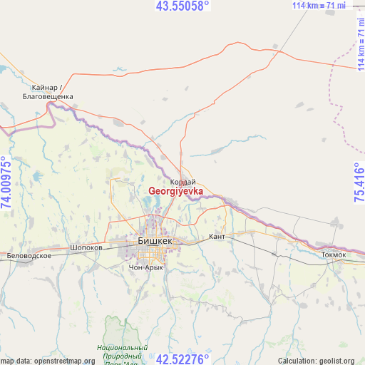
Georgiyevka GPS coordinates[2]
43° 2' 19.752" North, 74° 42' 46.332" East
| Map corner | latitude | longitude |
|---|---|---|
| Upper-left | 43.55058°, | 74.00975° |
| Center: | 43.03882°, | 74.71287° |
| Lower-right: | 42.52276°, | 75.416° |
| Map W x H: | 114.3×114.3 km | = 71×71mi |
| max Lat: | 54.90596° ⇑89.6% North |
| Georgiyevka: | 43.03882° |
| min Lat: | ⇓10.4% South 40.66338° |
| min Long | Georgiyevka | max Long |
| 46.83361° | 74.71287° | 84.87144° |
| W 72.2%⇐ | ⇒27.8% E |
Elevation
Elevation of Georgiyevka is 624 m = 2047 ft, and this is 267.5 m = 878 ft above average elevation for this country.
| Max E: |
1847 m = 6060 ft | 15.6% |
| Georgiyevka | 624 m 2047 ft | |
| Avg. | 356.5 m = 1170 ft | |
Min E: |
-26 m = -85 ft | 84.4% |
See also: Kazakhstan elevation on elevation.city.
Geographical zone
Georgiyevka is located in North temperate zone (between Tropic of Cancer and the Arctic Circle). Distance of this Northern Tropic circle is 2179.5 km =1354.3 mi to South.| Distance of | km | miles | from Georgiyevka |
|---|---|---|---|
| North Pole | 5221.6 | 3244.6 | to North |
| Arctic Circle | 2615.7 | 1625.3 | to North |
| Tropic Cancer | 2179.5 | 1354.3 | to South |
| Equator | 4785.5 | 2973.6 | to South |


Nearby cities:
15 places around Georgiyevka: (largest is in red/bold)
• Almaty
181.4 km =112.7 mi,  82°
82°
• Burunday
177.1 km =110 mi, 78°
• Chemolgan
159.4 km =99 mi, 76°
• Chu
99.5 km =61.8 mi,  309°
309°
• Granitogorsk
106.5 km =66.2 mi,  252°
252°
• Kapshagay
210.8 km =131 mi,  64°
64°
• Khantaū
151.4 km =94.1 mi,  330°
330°
• Lugovoy
159.1 km =98.9 mi,  266°
266°
• Lugovoye
162.7 km =101.1 mi,  264°
264°
• Merke
125.8 km =78.2 mi, 261°
• Moyynkum
198.8 km =123.5 mi, 314°
• Otegen Batyra
191.7 km =119.1 mi, 77°
• Oytal
118.3 km =73.5 mi, 262°
• Pervomayka
184.3 km =114.5 mi, 78°
• Talghar
207.1 km =128.7 mi, 81°
Sources, notices
• [Note1] Compared only with cities in Kazakhstan existing in our database
• [Src1] Map data: © OpenStreetMap contributors (CC-BY-SA)
• [Src2] Other city data from geonames.org with taken over terms of usage.
• [Src3] Geographical zone / Annual Mean Temperature by Robert A. Rohde @ Wikipedia
