Chu geodata
Chu (Zhambyl) is a populated place; located in Kazakhstan in Asia/Almaty (GMT+5) time zone. With population of 39,785 people, there are 40 cities with bigger population in this country. Compared to other cities in Kazakhstan, 81.9% of cities are located further ↑North; 70.4% of cities are located further ←West and 69.3% of cities have lower elevation than Chu. Note1


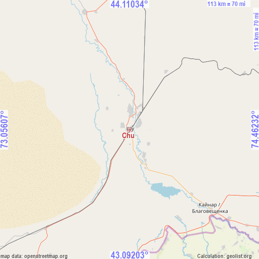
Chu GPS coordinates[2]
43° 36' 12.024" North, 73° 45' 33.084" East
| Map corner | latitude | longitude |
|---|---|---|
| Upper-left | 44.11034°, | 73.05607° |
| Center: | 43.60334°, | 73.75919° |
| Lower-right: | 43.09203°, | 74.46232° |
| Map W x H: | 113.2×113.2 km | = 70.3×70.3mi |
| max Lat: | 54.90596° ⇑81.9% North |
| Chu: | 43.60334° |
| min Lat: | ⇓18.1% South 40.66338° |
| min Long | Chu | max Long |
| 46.83361° | 73.75919° | 84.87144° |
| W 70.4%⇐ | ⇒29.6% E |
Elevation
Elevation of Chu is 470 m = 1542 ft, and this is 113.5 m = 372 ft above average elevation for this country.
| Max E: |
1847 m = 6060 ft | 30.7% |
| Chu | 470 m 1542 ft | |
| Avg. | 356.5 m = 1170 ft | |
Min E: |
-26 m = -85 ft | 69.3% |
See also: Kazakhstan elevation on elevation.city.
Geographical zone
Chu is located in North temperate zone (between Tropic of Cancer and the Arctic Circle). Distance of this Northern Tropic circle is 2242.3 km =1393.3 mi to South.| Distance of | km | miles | from Chu |
|---|---|---|---|
| North Pole | 5158.8 | 3205.5 | to North |
| Arctic Circle | 2552.9 | 1586.3 | to North |
| Tropic Cancer | 2242.3 | 1393.3 | to South |
| Equator | 4848.2 | 3012.5 | to South |


Nearby cities:
15 places around Chu: (largest is in red/bold)
• Aqbaqay
173.6 km =107.9 mi,  333°
333°
• Bakanas
241 km =149.8 mi,  56°
56°
• Chemolgan
232.5 km =144.5 mi,  96°
96°
• Georgiyevka
99.5 km =61.8 mi,  129°
129°
• Granitogorsk
98.4 km =61.1 mi,  193°
193°
• Khantaū
69.5 km =43.2 mi,  2°
2°
• Lugovoy
109.3 km =67.9 mi,  227°
227°
• Lugovoye
114.1 km =70.9 mi, 227°
• Merke
93.9 km =58.3 mi,  209°
209°
• Moyynkum
100.2 km =62.3 mi,  319°
319°
• Mynaral
201.6 km =125.3 mi,  358°
358°
• Oytal
87.1 km =54.1 mi, 207°
• Sarykemer
194.7 km =121 mi,  249°
249°
• Taraz
208.9 km =129.8 mi, 248°
• Ülken
179.7 km =111.7 mi,  5°
5°
Sources, notices
• [Note1] Compared only with cities in Kazakhstan existing in our database
• [Src1] Map data: © OpenStreetMap contributors (CC-BY-SA)
• [Src2] Other city data from geonames.org with taken over terms of usage.
• [Src3] Geographical zone / Annual Mean Temperature by Robert A. Rohde @ Wikipedia
