Moyynkum geodata
Moyynkum (Zhambyl) is a populated place; located in Kazakhstan in Asia/Almaty (GMT+5) time zone. With population of 10,923 people, there are 105 cities with bigger population in this country. Compared to other cities in Kazakhstan, 78.1% of cities are located further ↑North; 63.3% of cities are located further ←West and 53.7% of cities have lower elevation than Moyynkum. Note1


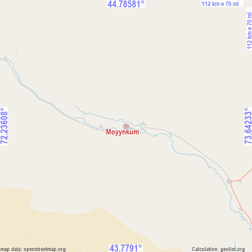
Moyynkum GPS coordinates[2]
44° 17' 4.596" North, 72° 56' 21.12" East
| Map corner | latitude | longitude |
|---|---|---|
| Upper-left | 44.78581°, | 72.23608° |
| Center: | 44.28461°, | 72.9392° |
| Lower-right: | 43.7791°, | 73.64233° |
| Map W x H: | 111.9×111.9 km | = 69.5×69.5mi |
| max Lat: | 54.90596° ⇑78.1% North |
| Moyynkum: | 44.28461° |
| min Lat: | ⇓21.9% South 40.66338° |
| min Long | Moyynkum | max Long |
| 46.83361° | 72.9392° | 84.87144° |
| W 63.3%⇐ | ⇒36.7% E |
Elevation
Elevation of Moyynkum is 352 m = 1155 ft, and this is 4.5 m = 15 ft below average elevation for this country.
| Max E: |
1847 m = 6060 ft | 46.3% |
| Avg. | 356.5 m = 1170 ft | |
| Moyynkum | 352 m = 1155 ft | |
Min E: |
-26 m = -85 ft | 53.7% |
See also: Kazakhstan elevation on elevation.city.
Geographical zone
Moyynkum is located in North temperate zone (between Tropic of Cancer and the Arctic Circle). Distance of this Northern Tropic circle is 2318.1 km =1440.4 mi to South.| Distance of | km | miles | from Moyynkum |
|---|---|---|---|
| North Pole | 5083.1 | 3158.5 | to North |
| Arctic Circle | 2477.2 | 1539.3 | to North |
| Tropic Cancer | 2318.1 | 1440.4 | to South |
| Equator | 4924 | 3059.6 | to South |


Nearby cities:
15 places around Moyynkum: (largest is in red/bold)
• Aqbaqay
80.5 km =50 mi,  351°
351°
• Chu
100.2 km =62.3 mi,  139°
139°
• Georgiyevka
198.8 km =123.5 mi,  134°
134°
• Granitogorsk
176.5 km =109.7 mi,  166°
166°
• Khantaū
68.5 km =42.6 mi,  95°
95°
• Lugovoy
150 km =93.2 mi,  185°
185°
• Lugovoye
153.8 km =95.6 mi, 186°
• Merke
158.6 km =98.5 mi, 172°
• Mynaral
138.8 km =86.2 mi,  25°
25°
• Oytal
155.6 km =96.7 mi, 170°
• Priozersk
203.2 km =126.3 mi,  17°
17°
• Sarykemer
183.9 km =114.3 mi,  219°
219°
• Saryshaghan
210.8 km =131 mi,  14°
14°
• Taraz
199.3 km =123.8 mi, 219°
• Ülken
131.8 km =81.9 mi,  38°
38°
Sources, notices
• [Note1] Compared only with cities in Kazakhstan existing in our database
• [Src1] Map data: © OpenStreetMap contributors (CC-BY-SA)
• [Src2] Other city data from geonames.org with taken over terms of usage.
• [Src3] Geographical zone / Annual Mean Temperature by Robert A. Rohde @ Wikipedia
