Tobol geodata
Tobol (Qostanay) is a populated place; located in Kazakhstan in Asia/Qostanay (GMT+5) time zone. With population of 7,155 people, there are 152 cities with bigger population in this country. Compared to other cities in Kazakhstan, 89.3% of cities are located further ↓South; 77% of cities are located further →East and 64.4% of cities have higher elevation than Tobol. Note1


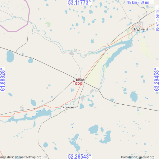
Tobol GPS coordinates[2]
52° 41' 37.176" North, 62° 35' 29.04" East
| Map corner | latitude | longitude |
|---|---|---|
| Upper-left | 53.11773°, | 61.88828° |
| Center: | 52.69366°, | 62.5914° |
| Lower-right: | 52.26543°, | 63.29453° |
| Map W x H: | 94.8×94.8 km | = 58.9×58.9mi |
| max Lat: | 54.90596° ⇑10.7% North |
| Tobol: | 52.69366° |
| min Lat: | ⇓89.3% South 40.66338° |
| min Long | Tobol | max Long |
| 46.83361° | 62.5914° | 84.87144° |
| W 23%⇐ | ⇒77% E |
Elevation
Elevation of Tobol is 207 m = 679 ft, and this is 149.5 m = 490 ft below average elevation for this country.
| Max E: |
1847 m = 6060 ft | 64.4% |
| Avg. | 356.5 m = 1170 ft | |
| Tobol | 207 m = 679 ft | |
Min E: |
-26 m = -85 ft | 35.6% |
See also: Kazakhstan elevation on elevation.city.
Geographical zone
Tobol is located in North temperate zone (between Tropic of Cancer and the Arctic Circle). Distance of this North polar circle is 1542.2 km =958.3 mi to North.| Distance of | km | miles | from Tobol |
|---|---|---|---|
| North Pole | 4148.1 | 2577.5 | to North |
| Arctic Circle | 1542.2 | 958.3 | to North |
| Tropic Cancer | 3253.1 | 2021.4 | to South |
| Equator | 5859 | 3640.6 | to South |


Nearby cities:
15 places around Tobol: (largest is in red/bold)
• Ayat
16.5 km =10.3 mi,  343°
343°
• Borovskoy
161.7 km =100.5 mi,  40°
40°
• Dzhetygara
109.7 km =68.2 mi,  239°
239°
• Esil
272.1 km =169.1 mi,  107°
107°
• Fyodorovka
105.2 km =65.4 mi,  3°
3°
• Karasu
195 km =121.2 mi,  91°
91°
• Komsomolets
122.7 km =76.2 mi, 343°
• Kostanay
90.2 km =56 mi,  50°
50°
• Krasnogorskiy
270.7 km =168.2 mi,  100°
100°
• Lisakovsk
17.4 km =10.8 mi,  200°
200°
• Ordzhonikidze
63.1 km =39.2 mi, 244°
• Qashar
77.2 km =48 mi,  13°
13°
• Qusmuryn
139.7 km =86.8 mi, 101°
• Rudnyy
47 km =29.2 mi, 48°
• Troyebratskiy
301.4 km =187.3 mi, 49°
Sources, notices
• [Note1] Compared only with cities in Kazakhstan existing in our database
• [Src1] Map data: © OpenStreetMap contributors (CC-BY-SA)
• [Src2] Other city data from geonames.org with taken over terms of usage.
• [Src3] Geographical zone / Annual Mean Temperature by Robert A. Rohde @ Wikipedia
