Qashar geodata
Qashar (Qostanay) is a populated place; located in Kazakhstan in Asia/Qostanay (GMT+5) time zone. With population of 10,285 people, there are 110 cities with bigger population in this country. Compared to other cities in Kazakhstan, 94.1% of cities are located further ↓South; 76.3% of cities are located further →East and 66.7% of cities have higher elevation than Qashar. Note1


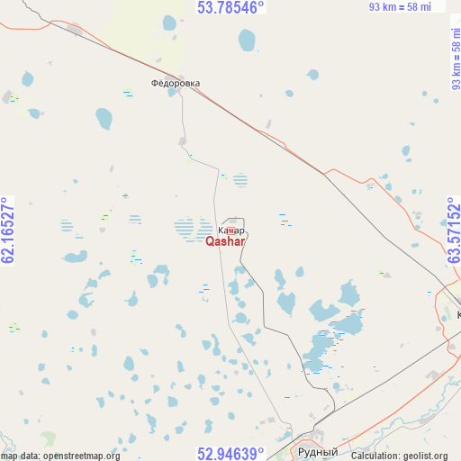
Qashar GPS coordinates[2]
53° 22' 4.764" North, 62° 52' 6.204" East
| Map corner | latitude | longitude |
|---|---|---|
| Upper-left | 53.78546°, | 62.16527° |
| Center: | 53.36799°, | 62.86839° |
| Lower-right: | 52.94639°, | 63.57152° |
| Map W x H: | 93.3×93.3 km | = 58×58mi |
| max Lat: | 54.90596° ⇑5.9% North |
| Qashar: | 53.36799° |
| min Lat: | ⇓94.1% South 40.66338° |
| min Long | Qashar | max Long |
| 46.83361° | 62.86839° | 84.87144° |
| W 23.7%⇐ | ⇒76.3% E |
Elevation
Elevation of Qashar is 197 m = 646 ft, and this is 159.5 m = 523 ft below average elevation for this country.
| Max E: |
1847 m = 6060 ft | 66.7% |
| Avg. | 356.5 m = 1170 ft | |
| Qashar | 197 m = 646 ft | |
Min E: |
-26 m = -85 ft | 33.3% |
See also: Kazakhstan elevation on elevation.city.
Geographical zone
Qashar is located in North temperate zone (between Tropic of Cancer and the Arctic Circle). Distance of this North polar circle is 1467.2 km =911.7 mi to North.| Distance of | km | miles | from Qashar |
|---|---|---|---|
| North Pole | 4073.1 | 2530.9 | to North |
| Arctic Circle | 1467.2 | 911.7 | to North |
| Tropic Cancer | 3328 | 2067.9 | to South |
| Equator | 5934 | 3687.2 | to South |


Nearby cities:
15 places around Qashar: (largest is in red/bold)
• Ayat
63.6 km =39.5 mi,  201°
201°
• Borovskoy
98.8 km =61.4 mi,  61°
61°
• Dzhetygara
172.5 km =107.2 mi,  220°
220°
• Fyodorovka
32.1 km =19.9 mi,  339°
339°
• Karasu
191.9 km =119.2 mi,  114°
114°
• Komsomolets
68.3 km =42.4 mi,  308°
308°
• Kostanay
53.1 km =33 mi, 108°
• Lisakovsk
94.6 km =58.8 mi, 195°
• Novoishimskiy
260 km =161.6 mi,  94°
94°
• Ordzhonikidze
126.9 km =78.9 mi, 216°
• Qusmuryn
155.5 km =96.6 mi,  130°
130°
• Rudnyy
46.9 km =29.1 mi,  159°
159°
• Timiryazevo
242.8 km =150.9 mi,  79°
79°
• Tobol
77.2 km =48 mi,  193°
193°
• Troyebratskiy
241.9 km =150.3 mi, 60°
Sources, notices
• [Note1] Compared only with cities in Kazakhstan existing in our database
• [Src1] Map data: © OpenStreetMap contributors (CC-BY-SA)
• [Src2] Other city data from geonames.org with taken over terms of usage.
• [Src3] Geographical zone / Annual Mean Temperature by Robert A. Rohde @ Wikipedia
