Ayat geodata
Ayat (Qostanay) is a populated place; located in Kazakhstan in Asia/Qostanay (GMT+5) time zone. With population of 3,130 people, there are 226 cities with bigger population in this country. Compared to other cities in Kazakhstan, 90% of cities are located further ↓South; 77.4% of cities are located further →East and 71.5% of cities have higher elevation than Ayat. Note1


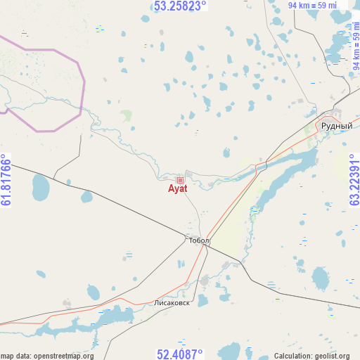
Ayat GPS coordinates[2]
52° 50' 7.944" North, 62° 31' 14.808" East
| Map corner | latitude | longitude |
|---|---|---|
| Upper-left | 53.25823°, | 61.81766° |
| Center: | 52.83554°, | 62.52078° |
| Lower-right: | 52.4087°, | 63.22391° |
| Map W x H: | 94.5×94.5 km | = 58.7×58.7mi |
| max Lat: | 54.90596° ⇑10% North |
| Ayat: | 52.83554° |
| min Lat: | ⇓90% South 40.66338° |
| min Long | Ayat | max Long |
| 46.83361° | 62.52078° | 84.87144° |
| W 22.6%⇐ | ⇒77.4% E |
Elevation
Elevation of Ayat is 168 m = 551 ft, and this is 188.5 m = 618 ft below average elevation for this country.
| Max E: |
1847 m = 6060 ft | 71.5% |
| Avg. | 356.5 m = 1170 ft | |
| Ayat | 168 m = 551 ft | |
Min E: |
-26 m = -85 ft | 28.5% |
See also: Kazakhstan elevation on elevation.city.
Geographical zone
Ayat is located in North temperate zone (between Tropic of Cancer and the Arctic Circle). Distance of this North polar circle is 1526.4 km =948.5 mi to North.| Distance of | km | miles | from Ayat |
|---|---|---|---|
| North Pole | 4132.3 | 2567.7 | to North |
| Arctic Circle | 1526.4 | 948.5 | to North |
| Tropic Cancer | 3268.8 | 2031.1 | to South |
| Equator | 5874.8 | 3650.4 | to South |


Nearby cities:
15 places around Ayat: (largest is in red/bold)
• Borovskoy
153.3 km =95.3 mi,  46°
46°
• Dzhetygara
114.7 km =71.3 mi,  231°
231°
• Esil
281.3 km =174.8 mi,  110°
110°
• Fyodorovka
90 km =55.9 mi,  7°
7°
• Karasu
200.4 km =124.5 mi,  95°
95°
• Komsomolets
106.2 km =66 mi,  343°
343°
• Kostanay
85 km =52.8 mi,  60°
60°
• Lisakovsk
32.1 km =19.9 mi,  182°
182°
• Ordzhonikidze
67.6 km =42 mi, 230°
• Qashar
63.6 km =39.5 mi,  21°
21°
• Qusmuryn
147.9 km =91.9 mi, 106°
• Rudnyy
42.8 km =26.6 mi,  69°
69°
• Tobol
16.5 km =10.3 mi,  163°
163°
• Torghay
362.4 km =225.2 mi,  169°
169°
• Troyebratskiy
294.9 km =183.2 mi, 52°
Sources, notices
• [Note1] Compared only with cities in Kazakhstan existing in our database
• [Src1] Map data: © OpenStreetMap contributors (CC-BY-SA)
• [Src2] Other city data from geonames.org with taken over terms of usage.
• [Src3] Geographical zone / Annual Mean Temperature by Robert A. Rohde @ Wikipedia
