Saryaghash geodata
Saryaghash (South Kazakhstan) is a populated place; located in Kazakhstan in Asia/Almaty (GMT+5) time zone. With population of 25,139 people, there are 59 cities with bigger population in this country. Compared to other cities in Kazakhstan, 98.5% of cities are located further ↑North; 58.1% of cities are located further →East and 67% of cities have lower elevation than Saryaghash. Note1


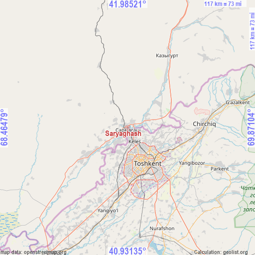
Saryaghash GPS coordinates[2]
41° 27' 37.512" North, 69° 10' 4.476" East
| Map corner | latitude | longitude |
|---|---|---|
| Upper-left | 41.98521°, | 68.46479° |
| Center: | 41.46042°, | 69.16791° |
| Lower-right: | 40.93135°, | 69.87104° |
| Map W x H: | 117.2×117.2 km | = 72.8×72.8mi |
| max Lat: | 54.90596° ⇑98.5% North |
| Saryaghash: | 41.46042° |
| min Lat: | ⇓1.5% South 40.66338° |
| min Long | Saryaghash | max Long |
| 46.83361° | 69.16791° | 84.87144° |
| W 41.9%⇐ | ⇒58.1% E |
Elevation
Elevation of Saryaghash is 441 m = 1447 ft, and this is 84.5 m = 277 ft above average elevation for this country.
| Max E: |
1847 m = 6060 ft | 33% |
| Saryaghash | 441 m 1447 ft | |
| Avg. | 356.5 m = 1170 ft | |
Min E: |
-26 m = -85 ft | 67% |
See also: Kazakhstan elevation on elevation.city.
Geographical zone
Saryaghash is located in North temperate zone (between Tropic of Cancer and the Arctic Circle). Distance of this Northern Tropic circle is 2004 km =1245.2 mi to South.| Distance of | km | miles | from Saryaghash |
|---|---|---|---|
| North Pole | 5397.1 | 3353.6 | to North |
| Arctic Circle | 2791.2 | 1734.4 | to North |
| Tropic Cancer | 2004 | 1245.2 | to South |
| Equator | 4610 | 2864.5 | to South |


Nearby cities:
15 places around Saryaghash: (largest is in red/bold)
• Arys
111.8 km =69.5 mi,  344°
344°
• Asyqata
92.1 km =57.2 mi,  226°
226°
• Atakent
87.8 km =54.6 mi,  219°
219°
• Belyye Vody
120 km =74.6 mi,  27°
27°
• Chardara
102.5 km =63.7 mi,  257°
257°
• Kokterek
145.9 km =90.7 mi,  38°
38°
• Lenger
99.8 km =62 mi, 36°
• Leninskoye
37.5 km =23.3 mi, 28°
• Myrzakent
102.9 km =63.9 mi,  210°
210°
• Sastobe
139.5 km =86.7 mi, 29°
• Sayram
105.6 km =65.6 mi, 27°
• Shymkent
100 km =62.1 mi,  20°
20°
• Temirlanovka
126.9 km =78.9 mi,  3°
3°
• Tyul’kubas
147.3 km =91.5 mi, 39°
• Zhabagly
153.5 km =95.4 mi, 44°
Sources, notices
• [Note1] Compared only with cities in Kazakhstan existing in our database
• [Src1] Map data: © OpenStreetMap contributors (CC-BY-SA)
• [Src2] Other city data from geonames.org with taken over terms of usage.
• [Src3] Geographical zone / Annual Mean Temperature by Robert A. Rohde @ Wikipedia
