Thakhèk geodata
Thakhèk (Khammouan) is a seat of a first-order administrative division; located in Laos in Asia/Vientiane (GMT+7) time zone. With population of 85,000 people, there are 2 cities with bigger population in this country. Compared to other cities in Laos, 65.4% of cities are located further ↑North; 67.3% of cities are located further ←West and 67.3% of cities have higher elevation than Thakhèk. Note1


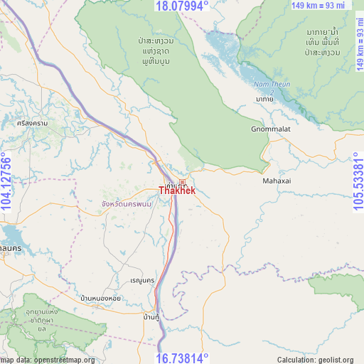
Thakhèk GPS coordinates[2]
17° 24' 36.972" North, 104° 49' 50.448" East
| Map corner | latitude | longitude |
|---|---|---|
| Upper-left | 18.07994°, | 104.12756° |
| Center: | 17.41027°, | 104.83068° |
| Lower-right: | 16.73814°, | 105.53381° |
| Map W x H: | 149.2×149.2 km | = 92.7×92.7mi |
| max Lat: | 21.6808° ⇑65.4% North |
| Thakhèk: | 17.41027° |
| min Lat: | ⇓34.6% South 14.11785° |
| min Long | Thakhèk | max Long |
| 100.4178° | 104.83068° | 107.26667° |
| W 67.3%⇐ | ⇒32.7% E |
Elevation
Elevation of Thakhèk is 176 m = 577 ft, and this is 297.6 m = 976 ft below average elevation for this country.
| Max E: |
1722 m = 5650 ft | 67.3% |
| Avg. | 473.6 m = 1554 ft | |
| Thakhèk | 176 m = 577 ft | |
Min E: |
83 m = 272 ft | 32.7% |
See also: Thakhèk elevation on elevation.city.
Geographical zone
Thakhèk is located in North Torrid zone (between Equator and Tropic of Cancer). Distance of this Northern Tropic circle is 670.1 km =416.4 mi to North.| Distance of | km | miles | from Thakhèk |
|---|---|---|---|
| North Pole | 8071.2 | 5015.2 | to North |
| Arctic Circle | 5465.3 | 3396 | to North |
| Tropic Cancer | 670.1 | 416.4 | to North |
| Equator | 1935.8 | 1202.8 | to South |


Nearby cities:
15 places around Thakhèk: (largest is in red/bold)
• Ban Dônghén
92.1 km =57.2 mi,  148°
148°
• Ban Nahin
113.3 km =70.4 mi,  324°
324°
• Ban Thatèng
275.2 km =171 mi,  143°
143°
• Borikhan
173.4 km =107.7 mi, 317°
• Muang Hinboun
31.3 km =19.4 mi,  309°
309°
• Muang Khamkeut
91.3 km =56.7 mi,  353°
353°
• Muang Mok
188.1 km =116.9 mi,  332°
332°
• Muang Phin
160 km =99.4 mi,  127°
127°
• Pakkading
134.8 km =83.8 mi, 318°
• Pakse
274.8 km =170.8 mi,  157°
157°
• Pakxan
165.2 km =102.7 mi, 311°
• Phônthong
271.4 km =168.6 mi, 161°
• Salavan
253.1 km =157.3 mi, 138°
• Savannakhet
93.7 km =58.2 mi,  184°
184°
• Vientiane
244.3 km =151.8 mi,  284°
284°
Sources, notices
• [Note1] Compared only with cities in Laos existing in our database
• [Src1] Map data: © OpenStreetMap contributors (CC-BY-SA)
• [Src2] Other city data from geonames.org with taken over terms of usage.
• [Src3] Geographical zone / Annual Mean Temperature by Robert A. Rohde @ Wikipedia
