Zalţan geodata
Zalţan (An Nuqāţ al Khams) is a populated place; located in Libya in Africa/Tripoli (GMT+2) time zone. With population of 17,700 people, there are 39 cities with bigger population in this country. Compared to other cities in Libya, 100% of cities are located further ↓South; 94.3% of cities are located further →East and 96.2% of cities have higher elevation than Zalţan. Note1


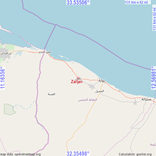
Zalţan GPS coordinates[2]
32° 56' 49.164" North, 11° 52' 0.048" East
| Map corner | latitude | longitude |
|---|---|---|
| Upper-left | 33.53506°, | 11.16356° |
| Center: | 32.94699°, | 11.86668° |
| Lower-right: | 32.35498°, | 12.56981° |
| Map W x H: | 131.2×131.2 km | = 81.5×81.5mi |
| max Lat: | 32.94699° ⇑0% North |
| Zalţan: | 32.94699° |
| min Lat: | ⇓100% South 24.1989° |
| min Long | Zalţan | max Long |
| 9.50072° | 11.86668° | 25.0866° |
| W 5.7%⇐ | ⇒94.3% E |
Elevation
Elevation of Zalţan is 4 m = 13 ft, and this is 228.2 m = 749 ft below average elevation for this country.
| Max E: |
704 m = 2310 ft | 96.2% |
| Avg. | 232.2 m = 762 ft | |
| Zalţan | 4 m = 13 ft | |
Min E: |
3 m = 10 ft | 3.8% |
See also: Libya elevation on elevation.city.
Geographical zone
Zalţan is located in North temperate zone (between Tropic of Cancer and the Arctic Circle). Distance of this Northern Tropic circle is 1057.4 km =657 mi to South.| Distance of | km | miles | from Zalţan |
|---|---|---|---|
| North Pole | 6343.7 | 3941.8 | to North |
| Arctic Circle | 3737.8 | 2322.6 | to North |
| Tropic Cancer | 1057.4 | 657 | to South |
| Equator | 3663.4 | 2276.3 | to South |


Nearby cities:
15 places around Zalţan: (largest is in red/bold)
• Al Ajaylat
52.1 km =32.4 mi,  113°
113°
• Al ‘Azīzīyah
117.1 km =72.8 mi, 113°
• Az Zāwīyah
83.1 km =51.6 mi,  104°
104°
• Gharyan
138.2 km =85.9 mi,  128°
128°
• Giado
111.3 km =69.2 mi,  172°
172°
• Nālūt
145.9 km =90.7 mi,  214°
214°
• Tagiura
138.7 km =86.2 mi,  93°
93°
• Tarhuna
174.8 km =108.6 mi, 109°
• Tripoli
123.4 km =76.7 mi, 93°
• Yafran
116.2 km =72.2 mi,  147°
147°
• Zawiya
83.3 km =51.8 mi, 105°
• Zintan
118.6 km =73.7 mi,  162°
162°
• Zuwārah
20.2 km =12.6 mi, 94°
• Şabrātah
60.5 km =37.6 mi, 106°
• Şurmān
69.2 km =43 mi, 107°
Sources, notices
• [Note1] Compared only with cities in Libya existing in our database
• [Src1] Map data: © OpenStreetMap contributors (CC-BY-SA)
• [Src2] Other city data from geonames.org with taken over terms of usage.
• [Src3] Geographical zone / Annual Mean Temperature by Robert A. Rohde @ Wikipedia
