Nālūt geodata
Nālūt is a seat of a first-order administrative division; located in Libya in Africa/Tripoli (GMT+2) time zone. With population of 26,256 people, there are 30 cities with bigger population in this country. Compared to other cities in Libya, 50.9% of cities are located further ↑North; 96.2% of cities are located further →East and 90.6% of cities have lower elevation than Nālūt. Note1


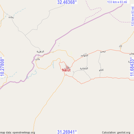
Nālūt GPS coordinates[2]
31° 52' 6.528" North, 10° 58' 52.32" East
| Map corner | latitude | longitude |
|---|---|---|
| Upper-left | 32.46368°, | 10.27808° |
| Center: | 31.86848°, | 10.9812° |
| Lower-right: | 31.26941°, | 11.68433° |
| Map W x H: | 132.8×132.8 km | = 82.5×82.5mi |
| max Lat: | 32.94699° ⇑50.9% North |
| Nālūt: | 31.86848° |
| min Lat: | ⇓49.1% South 24.1989° |
| min Long | Nālūt | max Long |
| 9.50072° | 10.9812° | 25.0866° |
| W 3.8%⇐ | ⇒96.2% E |
Elevation
Elevation of Nālūt is 637 m = 2090 ft, and this is 404.8 m = 1328 ft above average elevation for this country.
| Max E: |
704 m = 2310 ft | 9.4% |
| Nālūt | 637 m 2090 ft | |
| Avg. | 232.2 m = 762 ft | |
Min E: |
3 m = 10 ft | 90.6% |
See also: Libya elevation on elevation.city.
Geographical zone
Nālūt is located in North temperate zone (between Tropic of Cancer and the Arctic Circle). Distance of this Northern Tropic circle is 937.5 km =582.5 mi to South.| Distance of | km | miles | from Nālūt |
|---|---|---|---|
| North Pole | 6463.6 | 4016.3 | to North |
| Arctic Circle | 3857.7 | 2397.1 | to North |
| Tropic Cancer | 937.5 | 582.5 | to South |
| Equator | 3543.4 | 2201.8 | to South |


Nearby cities:
15 places around Nālūt: (largest is in red/bold)
• Al Ajaylat
164.2 km =102 mi,  52°
52°
• Al ‘Azīzīyah
205.3 km =127.6 mi,  68°
68°
• Az Zāwīyah
191.6 km =119.1 mi,  58°
58°
• Ghadāmis
239 km =148.5 mi,  216°
216°
• Gharyan
195.2 km =121.3 mi,  80°
80°
• Giado
99.4 km =61.8 mi, 84°
• Mizdah
195.3 km =121.4 mi,  103°
103°
• Tripoli
236.1 km =146.7 mi, 61°
• Yafran
147.6 km =91.7 mi, 81°
• Zalţan
145.9 km =90.7 mi,  34°
34°
• Zawiya
191.3 km =118.9 mi, 59°
• Zintan
120.2 km =74.7 mi,  86°
86°
• Zuwārah
157 km =97.6 mi,  41°
41°
• Şabrātah
175 km =108.7 mi, 54°
• Şurmān
179.1 km =111.3 mi, 56°
Sources, notices
• [Note1] Compared only with cities in Libya existing in our database
• [Src1] Map data: © OpenStreetMap contributors (CC-BY-SA)
• [Src2] Other city data from geonames.org with taken over terms of usage.
• [Src3] Geographical zone / Annual Mean Temperature by Robert A. Rohde @ Wikipedia
