Zawiya geodata
Zawiya (Az Zāwiyah) is a populated place; located in Libya in Africa/Tripoli (GMT+2) time zone. With population of 186,123 people, there are 6 cities with bigger population in this country. Compared to other cities in Libya, 79.2% of cities are located further ↓South; 77.4% of cities are located further →East and 66% of cities have higher elevation than Zawiya. Note1


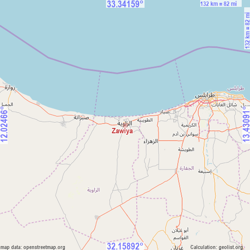
Zawiya GPS coordinates[2]
32° 45' 7.992" North, 12° 43' 40.008" East
| Map corner | latitude | longitude |
|---|---|---|
| Upper-left | 33.34159°, | 12.02466° |
| Center: | 32.75222°, | 12.72778° |
| Lower-right: | 32.15892°, | 13.43091° |
| Map W x H: | 131.5×131.5 km | = 81.7×81.7mi |
| max Lat: | 32.94699° ⇑20.8% North |
| Zawiya: | 32.75222° |
| min Lat: | ⇓79.2% South 24.1989° |
| min Long | Zawiya | max Long |
| 9.50072° | 12.72778° | 25.0866° |
| W 22.6%⇐ | ⇒77.4% E |
Elevation
Elevation of Zawiya is 21 m = 69 ft, and this is 211.2 m = 693 ft below average elevation for this country.
| Max E: |
704 m = 2310 ft | 66% |
| Avg. | 232.2 m = 762 ft | |
| Zawiya | 21 m = 69 ft | |
Min E: |
3 m = 10 ft | 34% |
See also: Zawiya elevation on elevation.city.
Geographical zone
Zawiya is located in North temperate zone (between Tropic of Cancer and the Arctic Circle). Distance of this Northern Tropic circle is 1035.8 km =643.6 mi to South.| Distance of | km | miles | from Zawiya |
|---|---|---|---|
| North Pole | 6365.4 | 3955.3 | to North |
| Arctic Circle | 3759.5 | 2336 | to North |
| Tropic Cancer | 1035.8 | 643.6 | to South |
| Equator | 3641.7 | 2262.8 | to South |


Nearby cities:
15 places around Zawiya: (largest is in red/bold)
• Al Ajaylat
32.9 km =20.4 mi,  270°
270°
• Al ‘Azīzīyah
36.5 km =22.7 mi,  132°
132°
• Az Zāwīyah
0.5 km =0.3 mi,  358°
358°
• Gharyan
70.1 km =43.6 mi,  156°
156°
• Giado
110.3 km =68.5 mi,  216°
216°
• Masallātah
120 km =74.6 mi,  97°
97°
• Tagiura
59.9 km =37.2 mi,  76°
76°
• Tarhuna
91.9 km =57.1 mi,  112°
112°
• Tripoli
45.5 km =28.3 mi,  70°
70°
• Yafran
78.9 km =49 mi,  193°
193°
• Zalţan
83.3 km =51.8 mi,  285°
285°
• Zintan
101.6 km =63.1 mi,  206°
206°
• Zuwārah
63.5 km =39.5 mi, 288°
• Şabrātah
22.8 km =14.2 mi,  281°
281°
• Şurmān
14.6 km =9.1 mi, 271°
Sources, notices
• [Note1] Compared only with cities in Libya existing in our database
• [Src1] Map data: © OpenStreetMap contributors (CC-BY-SA)
• [Src2] Other city data from geonames.org with taken over terms of usage.
• [Src3] Geographical zone / Annual Mean Temperature by Robert A. Rohde @ Wikipedia
