Giado geodata
Giado (Jabal al Gharbi) is a populated place; located in Libya in Africa/Tripoli (GMT+2) time zone. With population of 6,013 people, there are 46 cities with bigger population in this country. Compared to other cities in Libya, 52.8% of cities are located further ↓South; 92.5% of cities are located further →East and 96.2% of cities have lower elevation than Giado. Note1


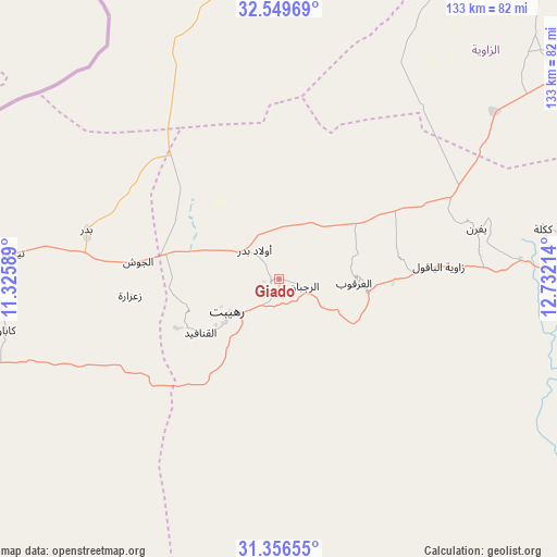
Giado GPS coordinates[2]
31° 57' 18.216" North, 12° 1' 44.436" East
| Map corner | latitude | longitude |
|---|---|---|
| Upper-left | 32.54969°, | 11.32589° |
| Center: | 31.95506°, | 12.02901° |
| Lower-right: | 31.35655°, | 12.73214° |
| Map W x H: | 132.7×132.7 km | = 82.5×82.5mi |
| max Lat: | 32.94699° ⇑47.2% North |
| Giado: | 31.95506° |
| min Lat: | ⇓52.8% South 24.1989° |
| min Long | Giado | max Long |
| 9.50072° | 12.02901° | 25.0866° |
| W 7.5%⇐ | ⇒92.5% E |
Elevation
Elevation of Giado is 693 m = 2274 ft, and this is 460.8 m = 1512 ft above average elevation for this country.
| Max E: |
704 m = 2310 ft | 3.8% |
| Giado | 693 m 2274 ft | |
| Avg. | 232.2 m = 762 ft | |
Min E: |
3 m = 10 ft | 96.2% |
See also: Libya elevation on elevation.city.
Geographical zone
Giado is located in North temperate zone (between Tropic of Cancer and the Arctic Circle). Distance of this Northern Tropic circle is 947.2 km =588.6 mi to South.| Distance of | km | miles | from Giado |
|---|---|---|---|
| North Pole | 6454 | 4010.3 | to North |
| Arctic Circle | 3848.1 | 2391.1 | to North |
| Tropic Cancer | 947.2 | 588.6 | to South |
| Equator | 3553.1 | 2207.8 | to South |


Nearby cities:
15 places around Giado: (largest is in red/bold)
• Al Ajaylat
95 km =59 mi,  20°
20°
• Al ‘Azīzīyah
112.9 km =70.2 mi,  55°
55°
• Az Zāwīyah
110.7 km =68.8 mi,  36°
36°
• Gharyan
96.5 km =60 mi,  75°
75°
• Mizdah
106.5 km =66.2 mi,  121°
121°
• Nālūt
99.4 km =61.8 mi,  264°
264°
• Tarhuna
160.1 km =99.5 mi,  70°
70°
• Tripoli
150.2 km =93.3 mi,  46°
46°
• Yafran
48.6 km =30.2 mi, 75°
• Zalţan
111.3 km =69.2 mi,  352°
352°
• Zawiya
110.3 km =68.5 mi, 36°
• Zintan
21.3 km =13.2 mi,  97°
97°
• Zuwārah
108.7 km =67.5 mi,  2°
2°
• Şabrātah
102.7 km =63.8 mi, 24°
• Şurmān
102.7 km =63.8 mi,  29°
29°
Sources, notices
• [Note1] Compared only with cities in Libya existing in our database
• [Src1] Map data: © OpenStreetMap contributors (CC-BY-SA)
• [Src2] Other city data from geonames.org with taken over terms of usage.
• [Src3] Geographical zone / Annual Mean Temperature by Robert A. Rohde @ Wikipedia
