Al Ajaylat geodata
Al Ajaylat (An Nuqāţ al Khams) is a populated place; located in Libya in Africa/Tripoli (GMT+2) time zone. With population of 130,546 people, there are 8 cities with bigger population in this country. Compared to other cities in Libya, 86.8% of cities are located further ↓South; 86.8% of cities are located further →East and 67.9% of cities have higher elevation than Al Ajaylat. Note1


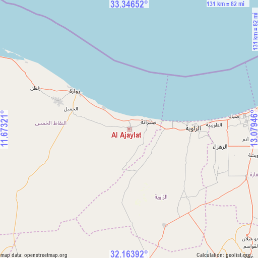
Al Ajaylat GPS coordinates[2]
32° 45' 25.848" North, 12° 22' 34.788" East
| Map corner | latitude | longitude |
|---|---|---|
| Upper-left | 33.34652°, | 11.67321° |
| Center: | 32.75718°, | 12.37633° |
| Lower-right: | 32.16392°, | 13.07946° |
| Map W x H: | 131.5×131.5 km | = 81.7×81.7mi |
| max Lat: | 32.94699° ⇑13.2% North |
| Al Ajaylat: | 32.75718° |
| min Lat: | ⇓86.8% South 24.1989° |
| min Long | Al Ajaylat | max Long |
| 9.50072° | 12.37633° | 25.0866° |
| W 13.2%⇐ | ⇒86.8% E |
Elevation
Elevation of Al Ajaylat is 19 m = 62 ft, and this is 213.2 m = 699 ft below average elevation for this country.
| Max E: |
704 m = 2310 ft | 67.9% |
| Avg. | 232.2 m = 762 ft | |
| Al Ajaylat | 19 m = 62 ft | |
Min E: |
3 m = 10 ft | 32.1% |
See also: Al Ajaylat elevation on elevation.city.
Geographical zone
Al Ajaylat is located in North temperate zone (between Tropic of Cancer and the Arctic Circle). Distance of this Northern Tropic circle is 1036.3 km =643.9 mi to South.| Distance of | km | miles | from Al Ajaylat |
|---|---|---|---|
| North Pole | 6364.8 | 3954.9 | to North |
| Arctic Circle | 3758.9 | 2335.7 | to North |
| Tropic Cancer | 1036.3 | 643.9 | to South |
| Equator | 3642.3 | 2263.2 | to South |


Nearby cities:
15 places around Al Ajaylat: (largest is in red/bold)
• Al ‘Azīzīyah
65 km =40.4 mi,  112°
112°
• Az Zāwīyah
32.9 km =20.4 mi,  90°
90°
• Gharyan
88.8 km =55.2 mi,  137°
137°
• Giado
95 km =59 mi,  200°
200°
• Masallātah
152.7 km =94.9 mi,  95°
95°
• Tagiura
92.1 km =57.2 mi,  81°
81°
• Tarhuna
123.1 km =76.5 mi, 106°
• Tripoli
77.2 km =48 mi, 79°
• Yafran
78.5 km =48.8 mi,  169°
169°
• Zalţan
52.1 km =32.4 mi,  293°
293°
• Zawiya
32.9 km =20.4 mi, 90°
• Zintan
92.5 km =57.5 mi,  187°
187°
• Zuwārah
33.6 km =20.9 mi,  305°
305°
• Şabrātah
11.2 km =7 mi,  69°
69°
• Şurmān
18.3 km =11.4 mi, 90°
Sources, notices
• [Note1] Compared only with cities in Libya existing in our database
• [Src1] Map data: © OpenStreetMap contributors (CC-BY-SA)
• [Src2] Other city data from geonames.org with taken over terms of usage.
• [Src3] Geographical zone / Annual Mean Temperature by Robert A. Rohde @ Wikipedia
