Az Zāwīyah geodata
Az Zāwīyah (Az Zāwiyah) is a seat of a first-order administrative division; located in Libya in Africa/Tripoli (GMT+2) time zone. With population of 200,000 people, there are 5 cities with bigger population in this country. Compared to other cities in Libya, 84.9% of cities are located further ↓South; 79.2% of cities are located further →East and 69.8% of cities have higher elevation than Az Zāwīyah. Note1


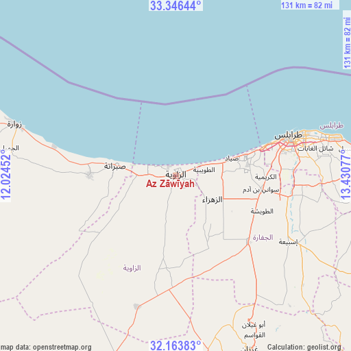
Az Zāwīyah GPS coordinates[2]
32° 45' 25.56" North, 12° 43' 39.504" East
| Map corner | latitude | longitude |
|---|---|---|
| Upper-left | 33.34644°, | 12.02452° |
| Center: | 32.7571°, | 12.72764° |
| Lower-right: | 32.16383°, | 13.43077° |
| Map W x H: | 131.5×131.5 km | = 81.7×81.7mi |
| max Lat: | 32.94699° ⇑15.1% North |
| Az Zāwīyah: | 32.7571° |
| min Lat: | ⇓84.9% South 24.1989° |
| min Long | Az Zāwīyah | max Long |
| 9.50072° | 12.72764° | 25.0866° |
| W 20.8%⇐ | ⇒79.2% E |
Elevation
Elevation of Az Zāwīyah is 18 m = 59 ft, and this is 214.2 m = 703 ft below average elevation for this country.
| Max E: |
704 m = 2310 ft | 69.8% |
| Avg. | 232.2 m = 762 ft | |
| Az Zāwīyah | 18 m = 59 ft | |
Min E: |
3 m = 10 ft | 30.2% |
See also: Az Zāwīyah elevation on elevation.city.
Geographical zone
Az Zāwīyah is located in North temperate zone (between Tropic of Cancer and the Arctic Circle). Distance of this Northern Tropic circle is 1036.3 km =643.9 mi to South.| Distance of | km | miles | from Az Zāwīyah |
|---|---|---|---|
| North Pole | 6364.8 | 3954.9 | to North |
| Arctic Circle | 3758.9 | 2335.7 | to North |
| Tropic Cancer | 1036.3 | 643.9 | to South |
| Equator | 3642.2 | 2263.2 | to South |


Nearby cities:
15 places around Az Zāwīyah: (largest is in red/bold)
• Al Ajaylat
32.9 km =20.4 mi,  270°
270°
• Al ‘Azīzīyah
36.9 km =22.9 mi,  132°
132°
• Gharyan
70.6 km =43.9 mi,  157°
157°
• Giado
110.7 km =68.8 mi,  216°
216°
• Masallātah
120.1 km =74.6 mi,  97°
97°
• Tagiura
59.8 km =37.2 mi,  76°
76°
• Tarhuna
92.1 km =57.2 mi,  112°
112°
• Tripoli
45.3 km =28.1 mi,  71°
71°
• Yafran
79.4 km =49.3 mi,  193°
193°
• Zalţan
83.1 km =51.6 mi,  284°
284°
• Zawiya
0.5 km =0.3 mi,  178°
178°
• Zintan
102.1 km =63.4 mi,  205°
205°
• Zuwārah
63.3 km =39.3 mi,  287°
287°
• Şabrātah
22.7 km =14.1 mi, 280°
• Şurmān
14.6 km =9.1 mi, 269°
Sources, notices
• [Note1] Compared only with cities in Libya existing in our database
• [Src1] Map data: © OpenStreetMap contributors (CC-BY-SA)
• [Src2] Other city data from geonames.org with taken over terms of usage.
• [Src3] Geographical zone / Annual Mean Temperature by Robert A. Rohde @ Wikipedia
