Zintan geodata
Zintan (Jabal al Gharbi) is a populated place; located in Libya in Africa/Tripoli (GMT+2) time zone. With population of 33,000 people, there are 27 cities with bigger population in this country. Compared to other cities in Libya, 50.9% of cities are located further ↓South; 88.7% of cities are located further →East and 98.1% of cities have lower elevation than Zintan. Note1


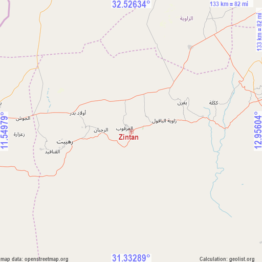
Zintan GPS coordinates[2]
31° 55' 53.58" North, 12° 15' 10.476" East
| Map corner | latitude | longitude |
|---|---|---|
| Upper-left | 32.52634°, | 11.54979° |
| Center: | 31.93155°, | 12.25291° |
| Lower-right: | 31.33289°, | 12.95604° |
| Map W x H: | 132.7×132.7 km | = 82.5×82.5mi |
| max Lat: | 32.94699° ⇑49.1% North |
| Zintan: | 31.93155° |
| min Lat: | ⇓50.9% South 24.1989° |
| min Long | Zintan | max Long |
| 9.50072° | 12.25291° | 25.0866° |
| W 11.3%⇐ | ⇒88.7% E |
Elevation
Elevation of Zintan is 700 m = 2297 ft, and this is 467.8 m = 1535 ft above average elevation for this country.
| Max E: |
704 m = 2310 ft | 1.9% |
| Zintan | 700 m 2297 ft | |
| Avg. | 232.2 m = 762 ft | |
Min E: |
3 m = 10 ft | 98.1% |
See also: Libya elevation on elevation.city.
Geographical zone
Zintan is located in North temperate zone (between Tropic of Cancer and the Arctic Circle). Distance of this Northern Tropic circle is 944.5 km =586.9 mi to South.| Distance of | km | miles | from Zintan |
|---|---|---|---|
| North Pole | 6456.6 | 4011.9 | to North |
| Arctic Circle | 3850.7 | 2392.7 | to North |
| Tropic Cancer | 944.5 | 586.9 | to South |
| Equator | 3550.5 | 2206.2 | to South |


Nearby cities:
15 places around Zintan: (largest is in red/bold)
• Al Ajaylat
92.5 km =57.5 mi,  7°
7°
• Al ‘Azīzīyah
98.1 km =61 mi,  47°
47°
• Az Zāwīyah
102.1 km =63.4 mi,  25°
25°
• Gharyan
77.1 km =47.9 mi,  69°
69°
• Giado
21.3 km =13.2 mi,  277°
277°
• Mizdah
87.6 km =54.4 mi,  127°
127°
• Nālūt
120.2 km =74.7 mi,  266°
266°
• Tarhuna
141.4 km =87.9 mi, 66°
• Tripoli
137.8 km =85.6 mi,  39°
39°
• Yafran
29.8 km =18.5 mi,  60°
60°
• Zalţan
118.6 km =73.7 mi,  342°
342°
• Zawiya
101.6 km =63.1 mi, 26°
• Zuwārah
112.3 km =69.8 mi,  351°
351°
• Şabrātah
98.3 km =61.1 mi, 12°
• Şurmān
96.5 km =60 mi,  18°
18°
Sources, notices
• [Note1] Compared only with cities in Libya existing in our database
• [Src1] Map data: © OpenStreetMap contributors (CC-BY-SA)
• [Src2] Other city data from geonames.org with taken over terms of usage.
• [Src3] Geographical zone / Annual Mean Temperature by Robert A. Rohde @ Wikipedia
