Şurmān geodata
Şurmān (Az Zāwiyah) is a populated place; located in Libya in Africa/Tripoli (GMT+2) time zone. With population of 25,235 people, there are 32 cities with bigger population in this country. Compared to other cities in Libya, 81.1% of cities are located further ↓South; 81.1% of cities are located further →East and 84.9% of cities have higher elevation than Şurmān. Note1


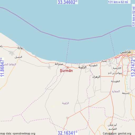
Şurmān GPS coordinates[2]
32° 45' 24.048" North, 12° 34' 17.724" East
| Map corner | latitude | longitude |
|---|---|---|
| Upper-left | 33.34602°, | 11.86847° |
| Center: | 32.75668°, | 12.57159° |
| Lower-right: | 32.16341°, | 13.27472° |
| Map W x H: | 131.5×131.5 km | = 81.7×81.7mi |
| max Lat: | 32.94699° ⇑18.9% North |
| Şurmān: | 32.75668° |
| min Lat: | ⇓81.1% South 24.1989° |
| min Long | Şurmān | max Long |
| 9.50072° | 12.57159° | 25.0866° |
| W 18.9%⇐ | ⇒81.1% E |
Elevation
Elevation of Şurmān is 8 m = 26 ft, and this is 224.2 m = 736 ft below average elevation for this country.
| Max E: |
704 m = 2310 ft | 84.9% |
| Avg. | 232.2 m = 762 ft | |
| Şurmān | 8 m = 26 ft | |
Min E: |
3 m = 10 ft | 15.1% |
See also: Libya elevation on elevation.city.
Geographical zone
Şurmān is located in North temperate zone (between Tropic of Cancer and the Arctic Circle). Distance of this Northern Tropic circle is 1036.3 km =643.9 mi to South.| Distance of | km | miles | from Şurmān |
|---|---|---|---|
| North Pole | 6364.9 | 3955 | to North |
| Arctic Circle | 3759 | 2335.7 | to North |
| Tropic Cancer | 1036.3 | 643.9 | to South |
| Equator | 3642.2 | 2263.2 | to South |


Nearby cities:
15 places around Şurmān: (largest is in red/bold)
• Al Ajaylat
18.3 km =11.4 mi,  270°
270°
• Al ‘Azīzīyah
48.7 km =30.3 mi,  120°
120°
• Az Zāwīyah
14.6 km =9.1 mi,  89°
89°
• Gharyan
77.4 km =48.1 mi,  147°
147°
• Giado
102.7 km =63.8 mi,  209°
209°
• Masallātah
134.6 km =83.6 mi,  96°
96°
• Tagiura
74.1 km =46 mi,  79°
79°
• Tarhuna
105.7 km =65.7 mi,  109°
109°
• Tripoli
59.3 km =36.8 mi, 75°
• Yafran
77.2 km =48 mi,  182°
182°
• Zalţan
69.2 km =43 mi,  287°
287°
• Zawiya
14.6 km =9.1 mi, 91°
• Zintan
96.5 km =60 mi,  198°
198°
• Zuwārah
49.7 km =30.9 mi, 292°
• Şabrātah
8.8 km =5.5 mi,  297°
297°
Sources, notices
• [Note1] Compared only with cities in Libya existing in our database
• [Src1] Map data: © OpenStreetMap contributors (CC-BY-SA)
• [Src2] Other city data from geonames.org with taken over terms of usage.
• [Src3] Geographical zone / Annual Mean Temperature by Robert A. Rohde @ Wikipedia
