Mizdah geodata
Mizdah (Jabal al Gharbi) is a populated place; located in Libya in Africa/Tripoli (GMT+2) time zone. With population of 26,107 people, there are 31 cities with bigger population in this country. Compared to other cities in Libya, 58.5% of cities are located further ↑North; 73.6% of cities are located further →East and 81.1% of cities have lower elevation than Mizdah. Note1


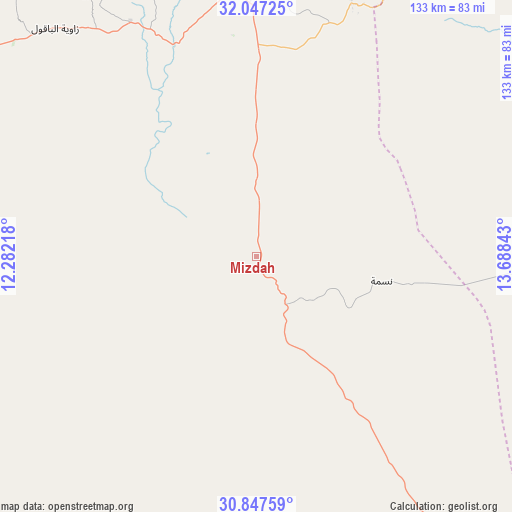
Mizdah GPS coordinates[2]
31° 26' 57.624" North, 12° 59' 7.08" East
| Map corner | latitude | longitude |
|---|---|---|
| Upper-left | 32.04725°, | 12.28218° |
| Center: | 31.44934°, | 12.9853° |
| Lower-right: | 30.84759°, | 13.68843° |
| Map W x H: | 133.4×133.4 km | = 82.9×82.9mi |
| max Lat: | 32.94699° ⇑58.5% North |
| Mizdah: | 31.44934° |
| min Lat: | ⇓41.5% South 24.1989° |
| min Long | Mizdah | max Long |
| 9.50072° | 12.9853° | 25.0866° |
| W 26.4%⇐ | ⇒73.6% E |
Elevation
Elevation of Mizdah is 458 m = 1503 ft, and this is 225.8 m = 741 ft above average elevation for this country.
| Max E: |
704 m = 2310 ft | 18.9% |
| Mizdah | 458 m 1503 ft | |
| Avg. | 232.2 m = 762 ft | |
Min E: |
3 m = 10 ft | 81.1% |
See also: Libya elevation on elevation.city.
Geographical zone
Mizdah is located in North temperate zone (between Tropic of Cancer and the Arctic Circle). Distance of this Northern Tropic circle is 890.9 km =553.6 mi to South.| Distance of | km | miles | from Mizdah |
|---|---|---|---|
| North Pole | 6510.2 | 4045.2 | to North |
| Arctic Circle | 3904.3 | 2426 | to North |
| Tropic Cancer | 890.9 | 553.6 | to South |
| Equator | 3496.8 | 2172.8 | to South |


Nearby cities:
15 places around Mizdah: (largest is in red/bold)
• Al Ajaylat
156.3 km =97.1 mi,  338°
338°
• Al ‘Azīzīyah
120.4 km =74.8 mi,  1°
1°
• Az Zāwīyah
147.4 km =91.6 mi,  350°
350°
• Bani Walid
100.1 km =62.2 mi,  70°
70°
• Gharyan
80.4 km =50 mi, 2°
• Giado
106.5 km =66.2 mi,  301°
301°
• Masallātah
161.2 km =100.2 mi,  36°
36°
• Tagiura
162.9 km =101.2 mi,  12°
12°
• Tarhuna
125.5 km =78 mi,  29°
29°
• Tripoli
161 km =100 mi, 6°
• Yafran
80.8 km =50.2 mi,  327°
327°
• Zawiya
146.9 km =91.3 mi, 350°
• Zintan
87.6 km =54.4 mi,  307°
307°
• Şabrātah
156.6 km =97.3 mi, 342°
• Şurmān
150.5 km =93.5 mi, 344°
Sources, notices
• [Note1] Compared only with cities in Libya existing in our database
• [Src1] Map data: © OpenStreetMap contributors (CC-BY-SA)
• [Src2] Other city data from geonames.org with taken over terms of usage.
• [Src3] Geographical zone / Annual Mean Temperature by Robert A. Rohde @ Wikipedia
