Awjilah geodata
Awjilah (Al Wāḩāt) is a populated place; located in Libya in Africa/Tripoli (GMT+2) time zone. With population of 6,610 people, there are 45 cities with bigger population in this country. Compared to other cities in Libya, 79.2% of cities are located further ↑North; 83% of cities are located further ←West and 58.5% of cities have higher elevation than Awjilah. Note1


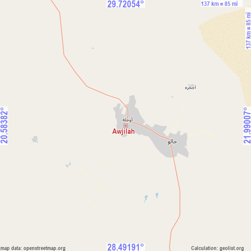
Awjilah GPS coordinates[2]
29° 6' 29.016" North, 21° 17' 12.984" East
| Map corner | latitude | longitude |
|---|---|---|
| Upper-left | 29.72054°, | 20.58382° |
| Center: | 29.10806°, | 21.28694° |
| Lower-right: | 28.49191°, | 21.99007° |
| Map W x H: | 136.6×136.6 km | = 84.9×84.9mi |
| max Lat: | 32.94699° ⇑79.2% North |
| Awjilah: | 29.10806° |
| min Lat: | ⇓20.8% South 24.1989° |
| min Long | Awjilah | max Long |
| 9.50072° | 21.28694° | 25.0866° |
| W 83%⇐ | ⇒17% E |
Elevation
Elevation of Awjilah is 41 m = 135 ft, and this is 191.2 m = 627 ft below average elevation for this country.
| Max E: |
704 m = 2310 ft | 58.5% |
| Avg. | 232.2 m = 762 ft | |
| Awjilah | 41 m = 135 ft | |
Min E: |
3 m = 10 ft | 41.5% |
See also: Libya elevation on elevation.city.
Geographical zone
Awjilah is located in North temperate zone (between Tropic of Cancer and the Arctic Circle). Distance of this Northern Tropic circle is 630.6 km =391.8 mi to South.| Distance of | km | miles | from Awjilah |
|---|---|---|---|
| North Pole | 6770.5 | 4207 | to North |
| Arctic Circle | 4164.7 | 2587.8 | to North |
| Tropic Cancer | 630.6 | 391.8 | to South |
| Equator | 3236.5 | 2011.1 | to South |


Nearby cities:
14 places around Awjilah: (largest is in red/bold)
• Ajdabiya
209.8 km =130.4 mi,  330°
330°
• Al Abyār
349 km =216.9 mi,  349°
349°
• Al Bayḑā’
408.8 km =254 mi,  6°
6°
• Al Burayqah
219.5 km =136.4 mi,  311°
311°
• Al Jaghbūb
320.6 km =199.2 mi,  77°
77°
• Al Marj
378.9 km =235.4 mi, 353°
• Al Qubbah
415.8 km =258.4 mi, 12°
• Az Zuwaytīnah
233.8 km =145.3 mi, 331°
• Benghazi
354.1 km =220 mi,  340°
340°
• Darnah
426.7 km =265.1 mi,  17°
17°
• Gialo
26.9 km =16.7 mi,  108°
108°
• Marādah
202.6 km =125.9 mi,  273°
273°
• Qaryat Sulūq
301.5 km =187.3 mi, 340°
• Tūkrah
386.9 km =240.4 mi, 349°
Sources, notices
• [Note1] Compared only with cities in Libya existing in our database
• [Src1] Map data: © OpenStreetMap contributors (CC-BY-SA)
• [Src2] Other city data from geonames.org with taken over terms of usage.
• [Src3] Geographical zone / Annual Mean Temperature by Robert A. Rohde @ Wikipedia
