Nyaungshwe geodata
Nyaungshwe (Mandalay) is a populated place; located in Myanmar in Asia/Yangon (GMT+6.5) time zone. With population of 1,300 people, there are 73 cities with bigger population in this country. Compared to other cities in Myanmar, 75.7% of cities are located further ↓South; 67.6% of cities are located further ←West and 91.9% of cities have lower elevation than Nyaungshwe. Note1


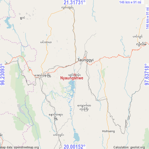
Nyaungshwe GPS coordinates[2]
20° 39' 39.024" North, 96° 56' 2.58" East
| Map corner | latitude | longitude |
|---|---|---|
| Upper-left | 21.31731°, | 96.23093° |
| Center: | 20.66084°, | 96.93405° |
| Lower-right: | 20.00152°, | 97.63718° |
| Map W x H: | 146.3×146.3 km | = 90.9×90.9mi |
| max Lat: | 25.38327° ⇑24.3% North |
| Nyaungshwe: | 20.66084° |
| min Lat: | ⇓75.7% South 9.98238° |
| min Long | Nyaungshwe | max Long |
| 92.89835° | 96.93405° | 99.88083° |
| W 67.6%⇐ | ⇒32.4% E |
Elevation
Elevation of Nyaungshwe is 894 m = 2933 ft, and this is 705.1 m = 2313 ft above average elevation for this country.
| Max E: |
1768 m = 5801 ft | 8.1% |
| Nyaungshwe | 894 m 2933 ft | |
| Avg. | 188.9 m = 620 ft | |
Min E: |
5 m = 16 ft | 91.9% |
See also: Myanmar elevation on elevation.city.
Geographical zone
Nyaungshwe is located in North Torrid zone (between Equator and Tropic of Cancer). Distance of this Northern Tropic circle is 308.6 km =191.8 mi to North.| Distance of | km | miles | from Nyaungshwe |
|---|---|---|---|
| North Pole | 7709.8 | 4790.6 | to North |
| Arctic Circle | 5103.9 | 3171.4 | to North |
| Tropic Cancer | 308.6 | 191.8 | to North |
| Equator | 2297.3 | 1427.5 | to South |


Nearby cities:
15 places around Nyaungshwe: (largest is in red/bold)
• Indein
24.2 km =15 mi,  203°
203°
• Kyaukse
133.8 km =83.1 mi,  321°
321°
• Loikaw
113 km =70.2 mi,  165°
165°
• Mandalay
170.6 km =106 mi,  328°
328°
• Meiktila
114.4 km =71.1 mi,  282°
282°
• Myingyan
183.3 km =113.9 mi,  298°
298°
• Nay Pyi Taw
132 km =82 mi,  219°
219°
• Pakokku
206.1 km =128.1 mi,  291°
291°
• Pyin Oo Lwin
160.6 km =99.8 mi,  342°
342°
• Pyinmana
127.6 km =79.3 mi, 216°
• Sagaing
167.7 km =104.2 mi, 323°
• Taungdwingyi
162 km =100.7 mi,  243°
243°
• Taunggyi
17.9 km =11.1 mi,  37°
37°
• Taungoo
198 km =123 mi, 195°
• Yamethin
86.6 km =53.8 mi,  252°
252°
Sources, notices
• [Note1] Compared only with cities in Myanmar existing in our database
• [Src1] Map data: © OpenStreetMap contributors (CC-BY-SA)
• [Src2] Other city data from geonames.org with taken over terms of usage.
• [Src3] Geographical zone / Annual Mean Temperature by Robert A. Rohde @ Wikipedia
