Loikaw geodata
Loikaw (Kayah) is a seat of a first-order administrative division; located in Myanmar in Asia/Yangon (GMT+6.5) time zone. With population of 17,293 people, there are 65 cities with bigger population in this country. Compared to other cities in Myanmar, 60.8% of cities are located further ↓South; 71.6% of cities are located further ←West and 90.5% of cities have lower elevation than Loikaw. Note1


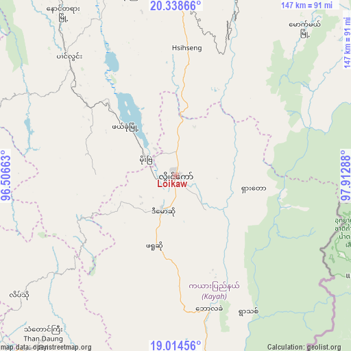
Loikaw GPS coordinates[2]
19° 40' 40.728" North, 97° 12' 35.1" East
| Map corner | latitude | longitude |
|---|---|---|
| Upper-left | 20.33866°, | 96.50663° |
| Center: | 19.67798°, | 97.20975° |
| Lower-right: | 19.01456°, | 97.91288° |
| Map W x H: | 147.2×147.2 km | = 91.5×91.5mi |
| max Lat: | 25.38327° ⇑39.2% North |
| Loikaw: | 19.67798° |
| min Lat: | ⇓60.8% South 9.98238° |
| min Long | Loikaw | max Long |
| 92.89835° | 97.20975° | 99.88083° |
| W 71.6%⇐ | ⇒28.4% E |
Elevation
Elevation of Loikaw is 893 m = 2930 ft, and this is 704.1 m = 2310 ft above average elevation for this country.
| Max E: |
1768 m = 5801 ft | 9.5% |
| Loikaw | 893 m 2930 ft | |
| Avg. | 188.9 m = 620 ft | |
Min E: |
5 m = 16 ft | 90.5% |
See also: Myanmar elevation on elevation.city.
Geographical zone
Loikaw is located in North Torrid zone (between Equator and Tropic of Cancer). Distance of this Northern Tropic circle is 417.9 km =259.7 mi to North.| Distance of | km | miles | from Loikaw |
|---|---|---|---|
| North Pole | 7819.1 | 4858.6 | to North |
| Arctic Circle | 5213.2 | 3239.3 | to North |
| Tropic Cancer | 417.9 | 259.7 | to North |
| Equator | 2188 | 1359.6 | to South |


Nearby cities:
15 places around Loikaw: (largest is in red/bold)
• Indein
95.2 km =59.2 mi,  336°
336°
• Meiktila
194.1 km =120.6 mi,  313°
313°
• Myaydo
211.8 km =131.6 mi,  260°
260°
• Nay Pyi Taw
113.3 km =70.4 mi,  273°
273°
• Nyaunglebin
198.5 km =123.3 mi,  194°
194°
• Nyaungshwe
113 km =70.2 mi,  345°
345°
• Paungde
222.4 km =138.2 mi,  233°
233°
• Pyay
229.2 km =142.4 mi,  245°
245°
• Pyinmana
105.1 km =65.3 mi, 273°
• Pyu
155.9 km =96.9 mi,  211°
211°
• Taungdwingyi
177.9 km =110.5 mi,  281°
281°
• Taunggyi
124.9 km =77.6 mi, 351°
• Taungoo
115.3 km =71.6 mi,  224°
224°
• Thayetmyo
216.1 km =134.3 mi, 259°
• Yamethin
139.8 km =86.9 mi, 306°
Sources, notices
• [Note1] Compared only with cities in Myanmar existing in our database
• [Src1] Map data: © OpenStreetMap contributors (CC-BY-SA)
• [Src2] Other city data from geonames.org with taken over terms of usage.
• [Src3] Geographical zone / Annual Mean Temperature by Robert A. Rohde @ Wikipedia
