Pyay geodata
Pyay (Bago) is a populated place; located in Myanmar in Asia/Yangon (GMT+6.5) time zone. With population of 135,308 people, there are 14 cities with bigger population in this country. Compared to other cities in Myanmar, 55.4% of cities are located further ↓South; 81.1% of cities are located further →East and 52.7% of cities have higher elevation than Pyay. Note1


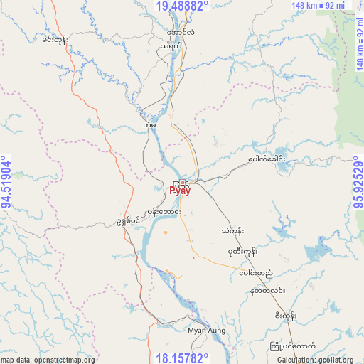
Pyay GPS coordinates[2]
18° 49' 28.704" North, 95° 13' 19.776" East
| Map corner | latitude | longitude |
|---|---|---|
| Upper-left | 19.48882°, | 94.51904° |
| Center: | 18.82464°, | 95.22216° |
| Lower-right: | 18.15782°, | 95.92529° |
| Map W x H: | 148×148 km | = 92×92mi |
| max Lat: | 25.38327° ⇑44.6% North |
| Pyay: | 18.82464° |
| min Lat: | ⇓55.4% South 9.98238° |
| min Long | Pyay | max Long |
| 92.89835° | 95.22216° | 99.88083° |
| W 18.9%⇐ | ⇒81.1% E |
Elevation
Elevation of Pyay is 32 m = 105 ft, and this is 156.9 m = 515 ft below average elevation for this country.
| Max E: |
1768 m = 5801 ft | 52.7% |
| Avg. | 188.9 m = 620 ft | |
| Pyay | 32 m = 105 ft | |
Min E: |
5 m = 16 ft | 47.3% |
See also: Pyay elevation on elevation.city.
Geographical zone
Pyay is located in North Torrid zone (between Equator and Tropic of Cancer). Distance of this Northern Tropic circle is 512.8 km =318.6 mi to North.| Distance of | km | miles | from Pyay |
|---|---|---|---|
| North Pole | 7914 | 4917.5 | to North |
| Arctic Circle | 5308.1 | 3298.3 | to North |
| Tropic Cancer | 512.8 | 318.6 | to North |
| Equator | 2093.1 | 1300.6 | to South |


Nearby cities:
15 places around Pyay: (largest is in red/bold)
• Hinthada
133 km =82.6 mi,  169°
169°
• Letpandan
128.2 km =79.7 mi,  154°
154°
• Magway
150.4 km =93.5 mi,  348°
348°
• Minbu
155.1 km =96.4 mi, 346°
• Myanaung
60.7 km =37.7 mi, 170°
• Myaydo
60.5 km =37.6 mi,  359°
359°
• Nay Pyi Taw
139.8 km =86.9 mi,  42°
42°
• Nyaunglebin
185.6 km =115.3 mi,  121°
121°
• Paungde
47.6 km =29.6 mi,  141°
141°
• Pyinmana
144.9 km =90 mi,  45°
45°
• Pyu
133.6 km =83 mi,  106°
106°
• Taungdwingyi
135.7 km =84.3 mi,  14°
14°
• Taungoo
128.2 km =79.7 mi,  84°
84°
• Tharyarwady
143.2 km =89 mi,  155°
155°
• Thayetmyo
55.3 km =34.4 mi, 355°
Sources, notices
• [Note1] Compared only with cities in Myanmar existing in our database
• [Src1] Map data: © OpenStreetMap contributors (CC-BY-SA)
• [Src2] Other city data from geonames.org with taken over terms of usage.
• [Src3] Geographical zone / Annual Mean Temperature by Robert A. Rohde @ Wikipedia
