Rumphi geodata
Rumphi (Northern Region) is a seat of a second-order administrative division; located in Malawi in Africa/Blantyre (GMT+2) time zone. With population of 20,727 people, there are 11 cities with bigger population in this country. Compared to other cities in Malawi, 91.4% of cities are located further ↓South; 82.9% of cities are located further →East and 65.7% of cities have lower elevation than Rumphi. Note1


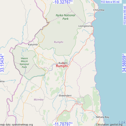
Rumphi GPS coordinates[2]
11° 1' 7.068" South, 33° 51' 26.856" East
| Map corner | latitude | longitude |
|---|---|---|
| Upper-left | -10.32767°, | 33.15434° |
| Center: | -11.01863°, | 33.85746° |
| Lower-right: | -11.70797°, | 34.56059° |
| Map W x H: | 153.5×153.5 km | = 95.4×95.4mi |
| max Lat: | -9.70237° ⇑8.6% North |
| Rumphi: | -11.01863° |
| min Lat: | ⇓91.4% South -16.91995° |
| min Long | Rumphi | max Long |
| 32.88019° | 33.85746° | 35.65067° |
| W 17.1%⇐ | ⇒82.9% E |
Elevation
Elevation of Rumphi is 1084 m = 3556 ft, and this is 215.3 m = 706 ft above average elevation for this country.
| Max E: |
1608 m = 5276 ft | 34.3% |
| Rumphi | 1084 m 3556 ft | |
| Avg. | 868.7 m = 2850 ft | |
Min E: |
55 m = 180 ft | 65.7% |
See also: Malawi elevation on elevation.city.
Geographical zone
Rumphi is located in South Torrid zone (between Equator and Tropic of Capricorn). Distance of Equator is 1225.2 km =761.3 mi to North.| Distance of | km | miles | from Rumphi |
|---|---|---|---|
| Equator | 1225.2 | 761.3 | to North |
| Tropic Capricorn | 1380.8 | 858 | to South |
| Antarctic Circle | 6176 | 3837.6 | to South |
| South Pole | 8781.9 | 5456.8 | to South |


Nearby cities:
15 places around Rumphi: (largest is in red/bold)
• Chitipa
159.9 km =99.4 mi,  336°
336°
• Dowa
293.2 km =182.2 mi,  178°
178°
• Karonga
121 km =75.2 mi,  3°
3°
• Kasungu
227.7 km =141.5 mi,  190°
190°
• Likoma
150.6 km =93.6 mi,  140°
140°
• Lilongwe
327.9 km =203.7 mi, 181°
• Livingstonia
53.3 km =33.1 mi,  30°
30°
• Mchinji
326.8 km =203.1 mi,  198°
198°
• Mponela
279.7 km =173.8 mi, 182°
• Mzimba
101.9 km =63.3 mi, 195°
• Mzuzu
52.8 km =32.8 mi,  160°
160°
• Nkhata Bay
80.7 km =50.1 mi, 144°
• Nkhotakota
217.5 km =135.1 mi,  167°
167°
• Ntchisi
279.1 km =173.4 mi, 178°
• Salima
313.9 km =195 mi, 167°
Sources, notices
• [Note1] Compared only with cities in Malawi existing in our database
• [Src1] Map data: © OpenStreetMap contributors (CC-BY-SA)
• [Src2] Other city data from geonames.org with taken over terms of usage.
• [Src3] Geographical zone / Annual Mean Temperature by Robert A. Rohde @ Wikipedia
