Nkhotakota geodata
Nkhotakota (Central Region) is a seat of a second-order administrative division; located in Malawi in Africa/Blantyre (GMT+2) time zone. With population of 24,865 people, there are 8 cities with bigger population in this country. Compared to other cities in Malawi, 77.1% of cities are located further ↓South; 62.9% of cities are located further →East and 82.9% of cities have higher elevation than Nkhotakota. Note1


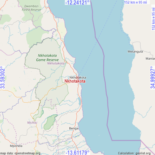
Nkhotakota GPS coordinates[2]
12° 55' 38.784" South, 34° 17' 46.104" East
| Map corner | latitude | longitude |
|---|---|---|
| Upper-left | -12.24121°, | 33.59302° |
| Center: | -12.92744°, | 34.29614° |
| Lower-right: | -13.61179°, | 34.99927° |
| Map W x H: | 152.4×152.4 km | = 94.7×94.7mi |
| max Lat: | -9.70237° ⇑22.9% North |
| Nkhotakota: | -12.92744° |
| min Lat: | ⇓77.1% South -16.91995° |
| min Long | Nkhotakota | max Long |
| 32.88019° | 34.29614° | 35.65067° |
| W 37.1%⇐ | ⇒62.9% E |
Elevation
Elevation of Nkhotakota is 497 m = 1631 ft, and this is 371.7 m = 1219 ft below average elevation for this country.
| Max E: |
1608 m = 5276 ft | 82.9% |
| Avg. | 868.7 m = 2850 ft | |
| Nkhotakota | 497 m = 1631 ft | |
Min E: |
55 m = 180 ft | 17.1% |
See also: Malawi elevation on elevation.city.
Geographical zone
Nkhotakota is located in South Torrid zone (between Equator and Tropic of Capricorn). Distance of this Southern Tropic circle is 1168.5 km =726.1 mi to South.| Distance of | km | miles | from Nkhotakota |
|---|---|---|---|
| Equator | 1437.4 | 893.2 | to North |
| Tropic Capricorn | 1168.5 | 726.1 | to South |
| Antarctic Circle | 5963.8 | 3705.7 | to South |
| South Pole | 8569.7 | 5325 | to South |


Nearby cities:
15 places around Nkhotakota: (largest is in red/bold)
• Chipoka
120.9 km =75.1 mi,  168°
168°
• Dedza
161.3 km =100.2 mi,  178°
178°
• Dowa
89.6 km =55.7 mi,  205°
205°
• Kasungu
88.9 km =55.2 mi,  262°
262°
• Likoma
106.8 km =66.4 mi,  26°
26°
• Lilongwe
128 km =79.5 mi, 205°
• Mangochi
201.7 km =125.3 mi,  148°
148°
• Mchinji
181.2 km =112.6 mi,  237°
237°
• Monkey Bay
144.9 km =90 mi, 152°
• Mponela
90.2 km =56 mi,  221°
221°
• Mzimba
137 km =85.1 mi,  326°
326°
• Mzuzu
165.3 km =102.7 mi,  349°
349°
• Nkhata Bay
146.9 km =91.3 mi,  359°
359°
• Ntchisi
78.5 km =48.8 mi, 211°
• Salima
96.5 km =60 mi, 169°
Sources, notices
• [Note1] Compared only with cities in Malawi existing in our database
• [Src1] Map data: © OpenStreetMap contributors (CC-BY-SA)
• [Src2] Other city data from geonames.org with taken over terms of usage.
• [Src3] Geographical zone / Annual Mean Temperature by Robert A. Rohde @ Wikipedia
