Lilongwe geodata
Lilongwe (Central Region) is a capital of a political entity; located in Malawi in Africa/Blantyre (GMT+2) time zone. With population of 646,750 people, there are 0 cities with bigger population in this country. Compared to other cities in Malawi, 57.1% of cities are located further ↓South; 85.7% of cities are located further →East and 62.9% of cities have lower elevation than Lilongwe. Note1


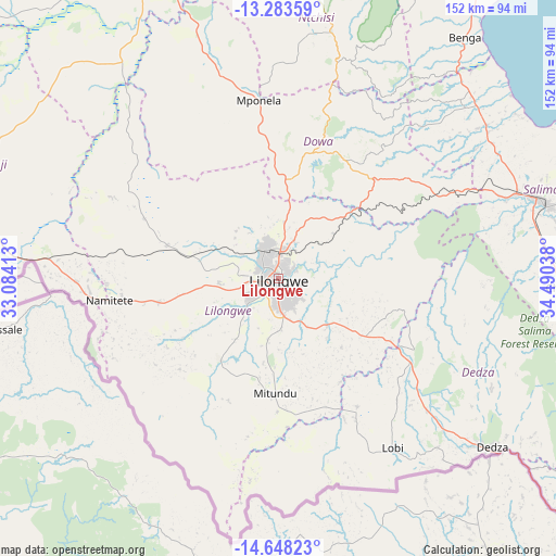
Lilongwe GPS coordinates[2]
13° 58' 0.912" South, 33° 47' 14.1" East
| Map corner | latitude | longitude |
|---|---|---|
| Upper-left | -13.28359°, | 33.08413° |
| Center: | -13.96692°, | 33.78725° |
| Lower-right: | -14.64823°, | 34.49038° |
| Map W x H: | 151.7×151.7 km | = 94.3×94.3mi |
| max Lat: | -9.70237° ⇑42.9% North |
| Lilongwe: | -13.96692° |
| min Lat: | ⇓57.1% South -16.91995° |
| min Long | Lilongwe | max Long |
| 32.88019° | 33.78725° | 35.65067° |
| W 14.3%⇐ | ⇒85.7% E |
Elevation
Elevation of Lilongwe is 1056 m = 3465 ft, and this is 187.3 m = 615 ft above average elevation for this country.
| Max E: |
1608 m = 5276 ft | 37.1% |
| Lilongwe | 1056 m 3465 ft | |
| Avg. | 868.7 m = 2850 ft | |
Min E: |
55 m = 180 ft | 62.9% |
See also: Lilongwe elevation on elevation.city.
Geographical zone
Lilongwe is located in South Torrid zone (between Equator and Tropic of Capricorn). Distance of this Southern Tropic circle is 1052.9 km =654.2 mi to South.| Distance of | km | miles | from Lilongwe |
|---|---|---|---|
| Equator | 1553 | 965 | to North |
| Tropic Capricorn | 1052.9 | 654.2 | to South |
| Antarctic Circle | 5848.2 | 3633.9 | to South |
| South Pole | 8454.1 | 5253.1 | to South |


Nearby cities:
15 places around Lilongwe: (largest is in red/bold)
• Balaka
168.8 km =104.9 mi,  131°
131°
• Chipoka
78.6 km =48.8 mi,  92°
92°
• Dedza
74.5 km =46.3 mi, 127°
• Dowa
38.4 km =23.9 mi,  25°
25°
• Kasungu
108.9 km =67.7 mi,  342°
342°
• Liwonde
197.3 km =122.6 mi, 128°
• Mangochi
169.1 km =105.1 mi,  109°
109°
• Mchinji
99.7 km =62 mi,  280°
280°
• Monkey Bay
122.5 km =76.1 mi,  96°
96°
• Mponela
48.6 km =30.2 mi,  353°
353°
• Neno
184.4 km =114.6 mi,  149°
149°
• Nkhotakota
128 km =79.5 mi, 25°
• Ntcheu
131.7 km =81.8 mi,  136°
136°
• Ntchisi
50.7 km =31.5 mi,  15°
15°
• Salima
75.4 km =46.9 mi,  74°
74°
Sources, notices
• [Note1] Compared only with cities in Malawi existing in our database
• [Src1] Map data: © OpenStreetMap contributors (CC-BY-SA)
• [Src2] Other city data from geonames.org with taken over terms of usage.
• [Src3] Geographical zone / Annual Mean Temperature by Robert A. Rohde @ Wikipedia
