Nkhata Bay geodata
Nkhata Bay (Northern Region) is a seat of a second-order administrative division; located in Malawi in Africa/Blantyre (GMT+2) time zone. With population of 11,721 people, there are 18 cities with bigger population in this country. Compared to other cities in Malawi, 85.7% of cities are located further ↓South; 65.7% of cities are located further →East and 71.4% of cities have higher elevation than Nkhata Bay. Note1


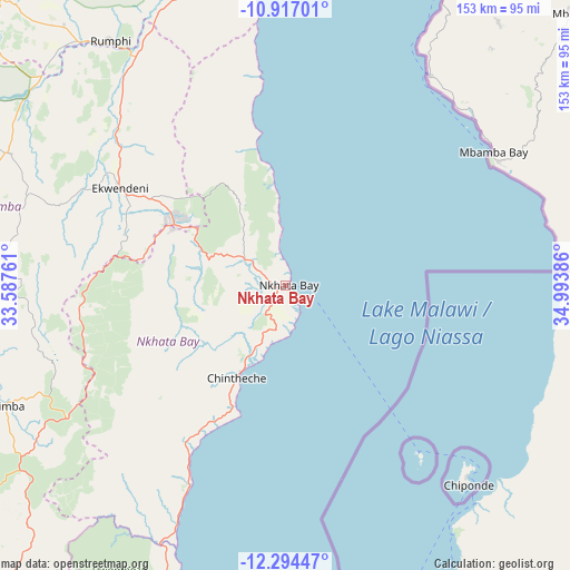
Nkhata Bay GPS coordinates[2]
11° 36' 23.724" South, 34° 17' 26.628" East
| Map corner | latitude | longitude |
|---|---|---|
| Upper-left | -10.91701°, | 33.58761° |
| Center: | -11.60659°, | 34.29073° |
| Lower-right: | -12.29447°, | 34.99386° |
| Map W x H: | 153.2×153.2 km | = 95.2×95.2mi |
| max Lat: | -9.70237° ⇑14.3% North |
| Nkhata Bay: | -11.60659° |
| min Lat: | ⇓85.7% South -16.91995° |
| min Long | Nkhata Bay | max Long |
| 32.88019° | 34.29073° | 35.65067° |
| W 34.3%⇐ | ⇒65.7% E |
Elevation
Elevation of Nkhata Bay is 547 m = 1795 ft, and this is 321.7 m = 1055 ft below average elevation for this country.
| Max E: |
1608 m = 5276 ft | 71.4% |
| Avg. | 868.7 m = 2850 ft | |
| Nkhata Bay | 547 m = 1795 ft | |
Min E: |
55 m = 180 ft | 28.6% |
See also: Malawi elevation on elevation.city.
Geographical zone
Nkhata Bay is located in South Torrid zone (between Equator and Tropic of Capricorn). Distance of Equator is 1290.5 km =801.9 mi to North.| Distance of | km | miles | from Nkhata Bay |
|---|---|---|---|
| Equator | 1290.5 | 801.9 | to North |
| Tropic Capricorn | 1315.4 | 817.4 | to South |
| Antarctic Circle | 6110.6 | 3796.9 | to South |
| South Pole | 8716.5 | 5416.2 | to South |


Nearby cities:
15 places around Nkhata Bay: (largest is in red/bold)
• Chipoka
266.5 km =165.6 mi,  174°
174°
• Chitipa
239.3 km =148.7 mi,  332°
332°
• Dowa
230.9 km =143.5 mi,  189°
189°
• Karonga
190.1 km =118.1 mi,  348°
348°
• Kasungu
181.3 km =112.7 mi,  208°
208°
• Likoma
70.3 km =43.7 mi,  136°
136°
• Lilongwe
268.1 km =166.6 mi, 191°
• Livingstonia
113.1 km =70.3 mi, 349°
• Mponela
222.3 km =138.1 mi,  195°
195°
• Mzimba
82 km =51 mi,  246°
246°
• Mzuzu
33.3 km =20.7 mi,  298°
298°
• Nkhotakota
146.9 km =91.3 mi,  179°
179°
• Ntchisi
217.5 km =135.1 mi, 190°
• Rumphi
80.7 km =50.1 mi,  324°
324°
• Salima
242.4 km =150.6 mi, 175°
Sources, notices
• [Note1] Compared only with cities in Malawi existing in our database
• [Src1] Map data: © OpenStreetMap contributors (CC-BY-SA)
• [Src2] Other city data from geonames.org with taken over terms of usage.
• [Src3] Geographical zone / Annual Mean Temperature by Robert A. Rohde @ Wikipedia
