Khorixas geodata
Khorixas (Kunene) is a populated place; located in Namibia in Africa/Windhoek (GMT+2) time zone. With population of 12,021 people, there are 16 cities with bigger population in this country. Compared to other cities in Namibia, 59.1% of cities are located further ↓South; 90.9% of cities are located further →East and 75% of cities have higher elevation than Khorixas. Note1


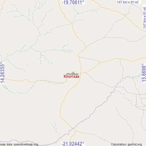
Khorixas GPS coordinates[2]
20° 22' 0.012" South, 14° 58' 0.012" East
| Map corner | latitude | longitude |
|---|---|---|
| Upper-left | -19.70611°, | 14.26355° |
| Center: | -20.36667°, | 14.96667° |
| Lower-right: | -21.02442°, | 15.6698° |
| Map W x H: | 146.6×146.6 km | = 91.1×91.1mi |
| max Lat: | -17.4° ⇑40.9% North |
| Khorixas: | -20.36667° |
| min Lat: | ⇓59.1% South -28.55° |
| min Long | Khorixas | max Long |
| 13.83998° | 14.96667° | 24.26667° |
| W 9.1%⇐ | ⇒90.9% E |
Elevation
Elevation of Khorixas is 972 m = 3189 ft, and this is 55.8 m = 183 ft below average elevation for this country.
| Max E: |
1656 m = 5433 ft | 75% |
| Avg. | 1027.8 m = 3372 ft | |
| Khorixas | 972 m = 3189 ft | |
Min E: |
1 m = 3 ft | 25% |
See also: Namibia elevation on elevation.city.
Geographical zone
Khorixas is located in South Torrid zone (between Equator and Tropic of Capricorn). Distance of this Southern Tropic circle is 341.4 km =212.1 mi to South.| Distance of | km | miles | from Khorixas |
|---|---|---|---|
| Equator | 2264.6 | 1407.2 | to North |
| Tropic Capricorn | 341.4 | 212.1 | to South |
| Antarctic Circle | 5136.6 | 3191.7 | to South |
| South Pole | 7742.5 | 4811 | to South |


Nearby cities:
15 places around Khorixas: (largest is in red/bold)
• Arandis
227.9 km =141.6 mi,  180°
180°
• Hentiesbaai
207.1 km =128.7 mi,  199°
199°
• Karibib
196 km =121.8 mi,  152°
152°
• Okahandja
270.5 km =168.1 mi,  131°
131°
• Okahao
275.8 km =171.4 mi,  2°
2°
• Okakarara
258.1 km =160.4 mi,  95°
95°
• Omaruru
155.4 km =96.6 mi,  139°
139°
• Omuthiya
279.7 km =173.8 mi,  37°
37°
• Ongandjera
276.3 km =171.7 mi, 2°
• Otavi
259.8 km =161.4 mi,  72°
72°
• Otjimbingwe
251.4 km =156.2 mi, 151°
• Otjiwarongo
175.5 km =109.1 mi,  93°
93°
• Outjo
126.5 km =78.6 mi,  77°
77°
• Swakopmund
261 km =162.2 mi,  190°
190°
• Usakos
193.1 km =120 mi,  160°
160°
Sources, notices
• [Note1] Compared only with cities in Namibia existing in our database
• [Src1] Map data: © OpenStreetMap contributors (CC-BY-SA)
• [Src2] Other city data from geonames.org with taken over terms of usage.
• [Src3] Geographical zone / Annual Mean Temperature by Robert A. Rohde @ Wikipedia
