Otjiwarongo geodata
Otjiwarongo (Otjozondjupa) is a seat of a first-order administrative division; located in Namibia in Africa/Windhoek (GMT+2) time zone. With population of 21,224 people, there are 9 cities with bigger population in this country. Compared to other cities in Namibia, 56.8% of cities are located further ↓South; 50% of cities are located further ←West and 95.5% of cities have lower elevation than Otjiwarongo. Note1


Otjiwarongo GPS coordinates[2]
20° 27' 49.284" South, 16° 38' 51.792" East
| Map corner | latitude | longitude |
|---|---|---|
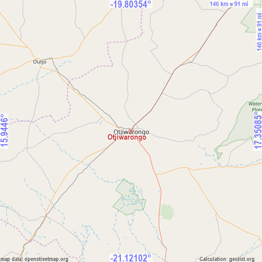
| Upper-left | -19.80354°, | 15.9446° |
| Center: | -20.46369°, | 16.64772° |
| Lower-right: | -21.12102°, | 17.35085° |
| Map W x H: | 146.5×146.5 km | = 91×91mi |
| max Lat: | -17.4° ⇑43.2% North |
| Otjiwarongo: | -20.46369° |
| min Lat: | ⇓56.8% South -28.55° |
| min Long | Otjiwarongo | max Long |
| 13.83998° | 16.64772° | 24.26667° |
| W 50%⇐ | ⇒50% E |
Elevation
Elevation of Otjiwarongo is 1475 m = 4839 ft, and this is 447.2 m = 1467 ft above average elevation for this country.
| Max E: |
1656 m = 5433 ft | 4.5% |
| Otjiwarongo | 1475 m 4839 ft | |
| Avg. | 1027.8 m = 3372 ft | |
Min E: |
1 m = 3 ft | 95.5% |
See also: Namibia elevation on elevation.city.
Geographical zone
Otjiwarongo is located in South Torrid zone (between Equator and Tropic of Capricorn). Distance of this Southern Tropic circle is 330.6 km =205.4 mi to South.| Distance of | km | miles | from Otjiwarongo |
|---|---|---|---|
| Equator | 2275.3 | 1413.8 | to North |
| Tropic Capricorn | 330.6 | 205.4 | to South |
| Antarctic Circle | 5125.8 | 3185 | to South |
| South Pole | 7731.7 | 4804.3 | to South |


Nearby cities:
15 places around Otjiwarongo: (largest is in red/bold)
• Arandis
278.2 km =172.9 mi,  218°
218°
• Grootfontein
183 km =113.7 mi,  56°
56°
• Karibib
183.9 km =114.3 mi,  207°
207°
• Katutura
232.9 km =144.7 mi,  169°
169°
• Khorixas
175.5 km =109.1 mi,  273°
273°
• Okahandja
171.3 km =106.4 mi, 170°
• Okakarara
82.9 km =51.5 mi,  99°
99°
• Omaruru
130.9 km =81.3 mi, 214°
• Omuthiya
233.5 km =145.1 mi,  358°
358°
• Otavi
115.4 km =71.7 mi,  38°
38°
• Otjimbingwe
216.4 km =134.5 mi,  194°
194°
• Outjo
64.7 km =40.2 mi,  306°
306°
• Tsumeb
176.7 km =109.8 mi, 39°
• Usakos
202.4 km =125.8 mi, 212°
• Windhoek
237.3 km =147.5 mi, 169°
Sources, notices
• [Note1] Compared only with cities in Namibia existing in our database
• [Src1] Map data: © OpenStreetMap contributors (CC-BY-SA)
• [Src2] Other city data from geonames.org with taken over terms of usage.
• [Src3] Geographical zone / Annual Mean Temperature by Robert A. Rohde @ Wikipedia
