Ongandjera geodata
Ongandjera (Omusati) is a populated place; located in Namibia in Africa/Windhoek (GMT+2) time zone. With population of 2,719 people, there are 37 cities with bigger population in this country. Compared to other cities in Namibia, 84.1% of cities are located further ↓South; 84.1% of cities are located further →East and 50% of cities have lower elevation than Ongandjera. Note1


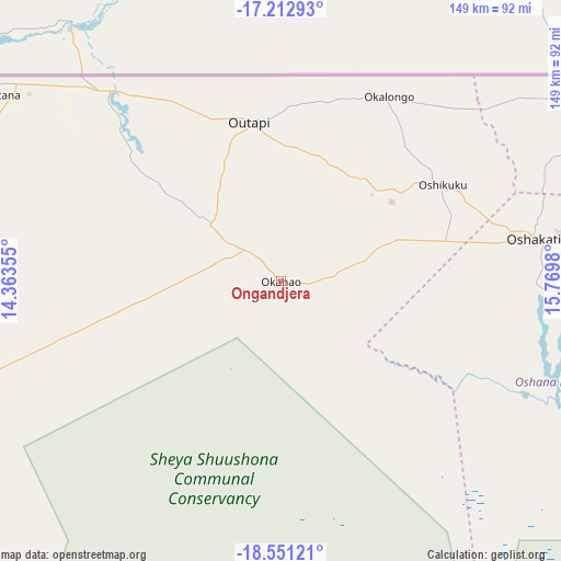
Ongandjera GPS coordinates[2]
17° 52' 59.988" South, 15° 4' 0.012" East
| Map corner | latitude | longitude |
|---|---|---|
| Upper-left | -17.21293°, | 14.36355° |
| Center: | -17.88333°, | 15.06667° |
| Lower-right: | -18.55121°, | 15.7698° |
| Map W x H: | 148.8×148.8 km | = 92.5×92.5mi |
| max Lat: | -17.4° ⇑15.9% North |
| Ongandjera: | -17.88333° |
| min Lat: | ⇓84.1% South -28.55° |
| min Long | Ongandjera | max Long |
| 13.83998° | 15.06667° | 24.26667° |
| W 15.9%⇐ | ⇒84.1% E |
Elevation
Elevation of Ongandjera is 1104 m = 3622 ft, and this is 76.2 m = 250 ft above average elevation for this country.
| Max E: |
1656 m = 5433 ft | 50% |
| Ongandjera | 1104 m 3622 ft | |
| Avg. | 1027.8 m = 3372 ft | |
Min E: |
1 m = 3 ft | 50% |
See also: Namibia elevation on elevation.city.
Geographical zone
Ongandjera is located in South Torrid zone (between Equator and Tropic of Capricorn). Distance of this Southern Tropic circle is 617.5 km =383.7 mi to South.| Distance of | km | miles | from Ongandjera |
|---|---|---|---|
| Equator | 1988.4 | 1235.5 | to North |
| Tropic Capricorn | 617.5 | 383.7 | to South |
| Antarctic Circle | 5412.7 | 3363.3 | to South |
| South Pole | 8018.6 | 4982.5 | to South |


Nearby cities:
15 places around Ongandjera: (largest is in red/bold)
• Eenhana
142 km =88.2 mi,  70°
70°
• Grootfontein
371.7 km =231 mi,  120°
120°
• Khorixas
276.3 km =171.7 mi,  182°
182°
• Okahao
0.5 km =0.3 mi, 178°
• Omuthiya
168.8 km =104.9 mi,  108°
108°
• Ondangwa
93.5 km =58.1 mi,  92°
92°
• Ongwediva
74.9 km =46.5 mi,  81°
81°
• Opuwo
131.2 km =81.5 mi,  261°
261°
• Oshakati
68.3 km =42.4 mi, 81°
• Oshikango
101.9 km =63.3 mi,  58°
58°
• Otavi
309.1 km =192.1 mi,  129°
129°
• Otjiwarongo
331.5 km =206 mi,  149°
149°
• Outapi
43.5 km =27 mi,  348°
348°
• Outjo
273.2 km =169.8 mi,  155°
155°
• Tsumeb
317.1 km =197 mi, 118°
Sources, notices
• [Note1] Compared only with cities in Namibia existing in our database
• [Src1] Map data: © OpenStreetMap contributors (CC-BY-SA)
• [Src2] Other city data from geonames.org with taken over terms of usage.
• [Src3] Geographical zone / Annual Mean Temperature by Robert A. Rohde @ Wikipedia
