Arandis geodata
Arandis (Erongo) is a populated place; located in Namibia in Africa/Windhoek (GMT+2) time zone. With population of 4,507 people, there are 33 cities with bigger population in this country. Compared to other cities in Namibia, 61.4% of cities are located further ↑North; 90.9% of cities are located further →East and 88.6% of cities have higher elevation than Arandis. Note1


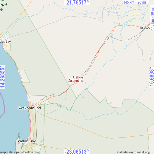
Arandis GPS coordinates[2]
22° 25' 0.012" South, 14° 58' 0.012" East
| Map corner | latitude | longitude |
|---|---|---|
| Upper-left | -21.76517°, | 14.26355° |
| Center: | -22.41667°, | 14.96667° |
| Lower-right: | -23.06513°, | 15.6698° |
| Map W x H: | 144.5×144.5 km | = 89.8×89.8mi |
| max Lat: | -17.4° ⇑61.4% North |
| Arandis: | -22.41667° |
| min Lat: | ⇓38.6% South -28.55° |
| min Long | Arandis | max Long |
| 13.83998° | 14.96667° | 24.26667° |
| W 9.1%⇐ | ⇒90.9% E |
Elevation
Elevation of Arandis is 570 m = 1870 ft, and this is 457.8 m = 1502 ft below average elevation for this country.
| Max E: |
1656 m = 5433 ft | 88.6% |
| Avg. | 1027.8 m = 3372 ft | |
| Arandis | 570 m = 1870 ft | |
Min E: |
1 m = 3 ft | 11.4% |
See also: Namibia elevation on elevation.city.
Geographical zone
Arandis is located in South Torrid zone (between Equator and Tropic of Capricorn). Distance of this Southern Tropic circle is 113.4 km =70.5 mi to South.| Distance of | km | miles | from Arandis |
|---|---|---|---|
| Equator | 2492.5 | 1548.8 | to North |
| Tropic Capricorn | 113.4 | 70.5 | to South |
| Antarctic Circle | 4908.7 | 3050.1 | to South |
| South Pole | 7514.6 | 4669.4 | to South |


Nearby cities:
15 places around Arandis: (largest is in red/bold)
• Hentiesbaai
77.8 km =48.3 mi,  295°
295°
• Karibib
104.2 km =64.7 mi,  58°
58°
• Katutura
215.4 km =133.8 mi,  93°
93°
• Khorixas
227.9 km =141.6 mi,  0°
0°
• Okahandja
206.4 km =128.3 mi,  76°
76°
• Okakarara
326.6 km =202.9 mi,  51°
51°
• Omaruru
148 km =92 mi,  42°
42°
• Otjimbingwe
120.2 km =74.7 mi, 86°
• Otjiwarongo
278.2 km =172.9 mi, 38°
• Outjo
283.6 km =176.2 mi,  25°
25°
• Rehoboth
239.5 km =148.8 mi,  114°
114°
• Swakopmund
53.7 km =33.4 mi,  237°
237°
• Usakos
80 km =49.7 mi, 54°
• Walvis Bay
76.5 km =47.5 mi,  218°
218°
• Windhoek
218 km =135.5 mi, 94°
Sources, notices
• [Note1] Compared only with cities in Namibia existing in our database
• [Src1] Map data: © OpenStreetMap contributors (CC-BY-SA)
• [Src2] Other city data from geonames.org with taken over terms of usage.
• [Src3] Geographical zone / Annual Mean Temperature by Robert A. Rohde @ Wikipedia
