Okahandja geodata
Okahandja (Otjozondjupa) is a populated place; located in Namibia in Africa/Windhoek (GMT+2) time zone. With population of 20,879 people, there are 10 cities with bigger population in this country. Compared to other cities in Namibia, 52.3% of cities are located further ↑North; 52.3% of cities are located further ←West and 79.5% of cities have lower elevation than Okahandja. Note1


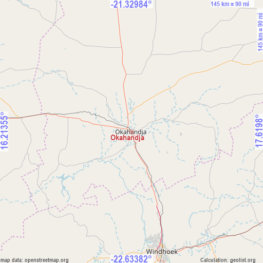
Okahandja GPS coordinates[2]
21° 58' 59.988" South, 16° 55' 0.012" East
| Map corner | latitude | longitude |
|---|---|---|
| Upper-left | -21.32984°, | 16.21355° |
| Center: | -21.98333°, | 16.91667° |
| Lower-right: | -22.63382°, | 17.6198° |
| Map W x H: | 145×145 km | = 90.1×90.1mi |
| max Lat: | -17.4° ⇑52.3% North |
| Okahandja: | -21.98333° |
| min Lat: | ⇓47.7% South -28.55° |
| min Long | Okahandja | max Long |
| 13.83998° | 16.91667° | 24.26667° |
| W 52.3%⇐ | ⇒47.7% E |
Elevation
Elevation of Okahandja is 1339 m = 4393 ft, and this is 311.2 m = 1021 ft above average elevation for this country.
| Max E: |
1656 m = 5433 ft | 20.5% |
| Okahandja | 1339 m 4393 ft | |
| Avg. | 1027.8 m = 3372 ft | |
Min E: |
1 m = 3 ft | 79.5% |
See also: Namibia elevation on elevation.city.
Geographical zone
Okahandja is located in South Torrid zone (between Equator and Tropic of Capricorn). Distance of this Southern Tropic circle is 161.6 km =100.4 mi to South.| Distance of | km | miles | from Okahandja |
|---|---|---|---|
| Equator | 2444.3 | 1518.8 | to North |
| Tropic Capricorn | 161.6 | 100.4 | to South |
| Antarctic Circle | 4956.9 | 3080.1 | to South |
| South Pole | 7562.7 | 4699.2 | to South |


Nearby cities:
15 places around Okahandja: (largest is in red/bold)
• Arandis
206.4 km =128.3 mi,  256°
256°
• Gobabis
217.3 km =135 mi,  103°
103°
• Hoachanas
244.3 km =151.8 mi,  151°
151°
• Karibib
111.9 km =69.5 mi,  272°
272°
• Katutura
61.8 km =38.4 mi,  166°
166°
• Okakarara
164.6 km =102.3 mi,  18°
18°
• Omaruru
118.6 km =73.7 mi,  301°
301°
• Otavi
263 km =163.4 mi,  9°
9°
• Otjimbingwe
90.4 km =56.2 mi,  243°
243°
• Otjiwarongo
171.3 km =106.4 mi,  350°
350°
• Outjo
222.3 km =138.1 mi,  339°
339°
• Rehoboth
149.4 km =92.8 mi, 173°
• Swakopmund
257.7 km =160.1 mi,  252°
252°
• Usakos
135.8 km =84.4 mi, 269°
• Windhoek
66.3 km =41.2 mi, 165°
Sources, notices
• [Note1] Compared only with cities in Namibia existing in our database
• [Src1] Map data: © OpenStreetMap contributors (CC-BY-SA)
• [Src2] Other city data from geonames.org with taken over terms of usage.
• [Src3] Geographical zone / Annual Mean Temperature by Robert A. Rohde @ Wikipedia
