Dhangaḍhi̇̄ geodata
Dhangaḍhi̇̄ (Far Western) is a populated place; located in Nepal in Asia/Kathmandu (GMT+5.75) time zone. With population of 92,294 people, there are 8 cities with bigger population in this country. Compared to other cities in Nepal, 85.1% of cities are located further ↓South; 95.9% of cities are located further →East and 74.3% of cities have higher elevation than Dhangaḍhi̇̄. Note1


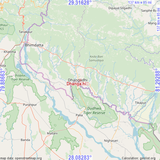
Dhangaḍhi̇̄ GPS coordinates[2]
28° 42' 4.932" North, 80° 35' 23.1" East
| Map corner | latitude | longitude |
|---|---|---|
| Upper-left | 29.31628°, | 79.88663° |
| Center: | 28.70137°, | 80.58975° |
| Lower-right: | 28.08283°, | 81.29288° |
| Map W x H: | 137.1×137.1 km | = 85.2×85.2mi |
| max Lat: | 30.04651° ⇑14.9% North |
| Dhangaḍhi̇̄: | 28.70137° |
| min Lat: | ⇓85.1% South 26.45505° |
| min Long | Dhangaḍhi̇̄ | max Long |
| 80.17715° | 80.58975° | 88.09436° |
| W 4.1%⇐ | ⇒95.9% E |
Elevation
Elevation of Dhangaḍhi̇̄ is 176 m = 577 ft, and this is 999.2 m = 3278 ft below average elevation for this country.
| Max E: |
5251 m = 17228 ft | 74.3% |
| Avg. | 1175.2 m = 3856 ft | |
| Dhangaḍhi̇̄ | 176 m = 577 ft | |
Min E: |
72 m = 236 ft | 25.7% |
See also: Dhangaḍhi̇̄ elevation on elevation.city.
Geographical zone
Dhangaḍhi̇̄ is located in North temperate zone (between Tropic of Cancer and the Arctic Circle). Distance of this Northern Tropic circle is 585.4 km =363.8 mi to South.| Distance of | km | miles | from Dhangaḍhi̇̄ |
|---|---|---|---|
| North Pole | 6815.8 | 4235.1 | to North |
| Arctic Circle | 4209.9 | 2615.9 | to North |
| Tropic Cancer | 585.4 | 363.8 | to South |
| Equator | 3191.3 | 1983 | to South |


Nearby cities:
15 places around Dhangaḍhi̇̄: (largest is in red/bold)
• Achhām
79.3 km =49.3 mi,  60°
60°
• Bardiyā
86.9 km =54 mi,  120°
120°
• Bhojpur
143.9 km =89.4 mi,  126°
126°
• Birendranagar
102.5 km =63.7 mi,  96°
96°
• Dadeldhurā
66.4 km =41.3 mi,  359°
359°
• Dailekh
110.3 km =68.5 mi,  81°
81°
• Dipayal
70.9 km =44.1 mi,  28°
28°
• Dārchulā
125.6 km =78 mi, 358°
• Gulariyā
92.2 km =57.3 mi, 126°
• Jumla
167.6 km =104.1 mi,  67°
67°
• Mahendranagar
49.7 km =30.9 mi,  306°
306°
• Nepalgunj
123.8 km =76.9 mi, 125°
• Salyān
158.5 km =98.5 mi, 103°
• Surkhet
117.8 km =73.2 mi, 99°
• Ṭikāpur
55 km =34.2 mi,  110°
110°
Sources, notices
• [Note1] Compared only with cities in Nepal existing in our database
• [Src1] Map data: © OpenStreetMap contributors (CC-BY-SA)
• [Src2] Other city data from geonames.org with taken over terms of usage.
• [Src3] Geographical zone / Annual Mean Temperature by Robert A. Rohde @ Wikipedia
