Ustupo geodata
Ustupo (Guna Yala) is a populated place; located in Panama in America/Panama (GMT-5) time zone. With population of 2,514 people, there are 101 cities with bigger population in this country. Compared to other cities in Panama, 88.5% of cities are located further ↓South; 97.7% of cities are located further ←West and 97.4% of cities have higher elevation than Ustupo. Note1


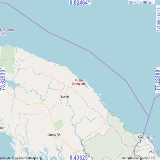
Ustupo GPS coordinates[2]
9° 7' 52.032" North, 77° 55' 34.32" West
| Map corner | latitude | longitude |
|---|---|---|
| Upper-left | 9.82464°, | -78.62933° |
| Center: | 9.13112°, | -77.9262° |
| Lower-right: | 8.43625°, | -77.22308° |
| Map W x H: | 154.4×154.4 km | = 95.9×95.9mi |
| max Lat: | 9.60898° ⇑11.5% North |
| Ustupo: | 9.13112° |
| min Lat: | ⇓88.5% South 7.26534° |
| min Long | Ustupo | max Long |
| -82.91275° | -77.9262° | -77.38965° |
| W 97.7%⇐ | ⇒2.3% E |
Elevation
Elevation of Ustupo is 5 m = 16 ft, and this is 167.1 m = 548 ft below average elevation for this country.
| Max E: |
2103 m = 6900 ft | 97.4% |
| Avg. | 172.1 m = 565 ft | |
| Ustupo | 5 m = 16 ft | |
Min E: |
-1 m = -3 ft | 2.6% |
See also: Panama elevation on elevation.city.
Geographical zone
Ustupo is located in North Torrid zone (between Equator and Tropic of Cancer). Distance of Equator is 1015.3 km =630.9 mi to South.| Distance of | km | miles | from Ustupo |
|---|---|---|---|
| North Pole | 8991.8 | 5587.2 | to North |
| Arctic Circle | 6385.9 | 3968 | to North |
| Tropic Cancer | 1590.6 | 988.4 | to North |
| Equator | 1015.3 | 630.9 | to South |


Nearby cities:
15 places around Ustupo: (largest is in red/bold)
• Achutupo
10 km =6.2 mi,  318°
318°
• Agua Fría Número Uno
42.5 km =26.4 mi,  224°
224°
• Ailigandí
15.5 km =9.6 mi,  314°
314°
• Cañazas
41.7 km =25.9 mi,  231°
231°
• Coetupo
36.3 km =22.6 mi,  135°
135°
• Mortí
31 km =19.3 mi,  178°
178°
• Mortí
32.5 km =20.2 mi,  189°
189°
• Mulatupo
28.1 km =17.5 mi, 136°
• Playón Chico
39.2 km =24.4 mi,  300°
300°
• Quebrada Honda
58.8 km =36.5 mi,  200°
200°
• San Ignacio de Tupile
30.4 km =18.9 mi, 305°
• Tortí
57.6 km =35.8 mi,  246°
246°
• Tubualá
32.2 km =20 mi, 136°
• Ualá
21.9 km =13.6 mi, 222°
• Zapallal
58.1 km =36.1 mi, 202°
Sources, notices
• [Note1] Compared only with cities in Panama existing in our database
• [Src1] Map data: © OpenStreetMap contributors (CC-BY-SA)
• [Src2] Other city data from geonames.org with taken over terms of usage.
• [Src3] Geographical zone / Annual Mean Temperature by Robert A. Rohde @ Wikipedia
