Wewak geodata
Wewak (East Sepik) is a seat of a first-order administrative division; located in Papua New Guinea in Pacific/Port_Moresby (GMT+10) time zone. With population of 18,230 people, there are 10 cities with bigger population in this country. Compared to other cities in Papua New Guinea, 90.9% of cities are located further ↓South; 81.8% of cities are located further →East and 52.3% of cities have lower elevation than Wewak. Note1


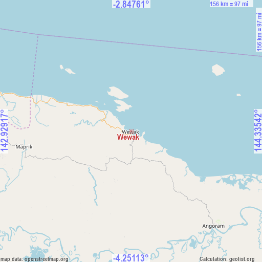
Wewak GPS coordinates[2]
3° 32' 58.704" South, 143° 37' 56.244" East
| Map corner | latitude | longitude |
|---|---|---|
| Upper-left | -2.84761°, | 142.92917° |
| Center: | -3.54964°, | 143.63229° |
| Lower-right: | -4.25113°, | 144.33542° |
| Map W x H: | 156.1×156.1 km | = 97×97mi |
| max Lat: | -2.0341° ⇑9.1% North |
| Wewak: | -3.54964° |
| min Lat: | ⇓90.9% South -10.61038° |
| min Long | Wewak | max Long |
| 141.29061° | 143.63229° | 155.69147° |
| W 18.2%⇐ | ⇒81.8% E |
Elevation
Elevation of Wewak is 44 m = 144 ft, and this is 537 m = 1762 ft below average elevation for this country.
| Max E: |
2248 m = 7375 ft | 47.7% |
| Avg. | 581 m = 1906 ft | |
| Wewak | 44 m = 144 ft | |
Min E: |
0 m = 0 ft | 52.3% |
See also: Papua New Guinea elevation on elevation.city.
Geographical zone
Wewak is located in South Torrid zone (between Equator and Tropic of Capricorn). Distance of Equator is 394.7 km =245.3 mi to North.| Distance of | km | miles | from Wewak |
|---|---|---|---|
| Equator | 394.7 | 245.3 | to North |
| Tropic Capricorn | 2211.2 | 1374 | to South |
| Antarctic Circle | 7006.5 | 4353.6 | to South |
| South Pole | 9612.4 | 5972.9 | to South |


Nearby cities:
15 places around Wewak: (largest is in red/bold)
• Aitape
149.6 km =93 mi,  287°
287°
• Ambunti
116.9 km =72.6 mi,  230°
230°
• Angoram
74.6 km =46.4 mi,  139°
139°
• Ialibu
306.4 km =190.4 mi,  172°
172°
• Kurumul
279.2 km =173.5 mi,  156°
156°
• Laiagam
198.8 km =123.5 mi, 174°
• Madang
302.7 km =188.1 mi,  127°
127°
• Mendi
288.9 km =179.5 mi,  179°
179°
• Minj
287.2 km =178.5 mi, 155°
• Mount Hagen
265 km =164.7 mi, 165°
• Porgera
219.4 km =136.3 mi,  194°
194°
• Rauna
253.7 km =157.6 mi, 163°
• Tari
266.3 km =165.5 mi,  196°
196°
• Vanimo
276.1 km =171.6 mi, 290°
• Wabag
216.1 km =134.3 mi, 177°
Sources, notices
• [Note1] Compared only with cities in Papua New Guinea existing in our database
• [Src1] Map data: © OpenStreetMap contributors (CC-BY-SA)
• [Src2] Other city data from geonames.org with taken over terms of usage.
• [Src3] Geographical zone / Annual Mean Temperature by Robert A. Rohde @ Wikipedia
