Mendi geodata
Mendi (Southern Highlands) is a seat of a first-order administrative division; located in Papua New Guinea in Pacific/Port_Moresby (GMT+10) time zone. With population of 26,252 people, there are 7 cities with bigger population in this country. Compared to other cities in Papua New Guinea, 52.3% of cities are located further ↑North; 79.5% of cities are located further →East and 90.9% of cities have lower elevation than Mendi. Note1


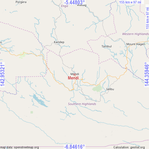
Mendi GPS coordinates[2]
6° 8' 51.18" South, 143° 39' 22.788" East
| Map corner | latitude | longitude |
|---|---|---|
| Upper-left | -5.44803°, | 142.95321° |
| Center: | -6.14755°, | 143.65633° |
| Lower-right: | -6.84616°, | 144.35946° |
| Map W x H: | 155.5×155.5 km | = 96.6×96.6mi |
| max Lat: | -2.0341° ⇑52.3% North |
| Mendi: | -6.14755° |
| min Lat: | ⇓47.7% South -10.61038° |
| min Long | Mendi | max Long |
| 141.29061° | 143.65633° | 155.69147° |
| W 20.5%⇐ | ⇒79.5% E |
Elevation
Elevation of Mendi is 1729 m = 5673 ft, and this is 1148 m = 3766 ft above average elevation for this country.
| Max E: |
2248 m = 7375 ft | 9.1% |
| Mendi | 1729 m 5673 ft | |
| Avg. | 581 m = 1906 ft | |
Min E: |
0 m = 0 ft | 90.9% |
See also: Papua New Guinea elevation on elevation.city.
Geographical zone
Mendi is located in South Torrid zone (between Equator and Tropic of Capricorn). Distance of Equator is 683.5 km =424.7 mi to North.| Distance of | km | miles | from Mendi |
|---|---|---|---|
| Equator | 683.5 | 424.7 | to North |
| Tropic Capricorn | 1922.4 | 1194.5 | to South |
| Antarctic Circle | 6717.6 | 4174.1 | to South |
| South Pole | 9323.5 | 5793.4 | to South |


Nearby cities:
15 places around Mendi: (largest is in red/bold)
• Ambunti
233.8 km =145.3 mi,  336°
336°
• Angoram
236.2 km =146.8 mi,  11°
11°
• Goroka
191.4 km =118.9 mi,  87°
87°
• Ialibu
40.2 km =25 mi,  111°
111°
• Kainantu
244.7 km =152 mi, 93°
• Kundiawa
145.8 km =90.6 mi,  84°
84°
• Kurumul
112.6 km =70 mi,  73°
73°
• Laiagam
92 km =57.2 mi, 9°
• Madang
257.2 km =159.8 mi, 66°
• Minj
117.5 km =73 mi, 76°
• Mount Hagen
71.2 km =44.2 mi,  63°
63°
• Porgera
94.6 km =58.8 mi,  323°
323°
• Rauna
83.5 km =51.9 mi, 56°
• Tari
85.4 km =53.1 mi,  293°
293°
• Wabag
73.3 km =45.5 mi, 5°
Sources, notices
• [Note1] Compared only with cities in Papua New Guinea existing in our database
• [Src1] Map data: © OpenStreetMap contributors (CC-BY-SA)
• [Src2] Other city data from geonames.org with taken over terms of usage.
• [Src3] Geographical zone / Annual Mean Temperature by Robert A. Rohde @ Wikipedia
