Wabag geodata
Wabag (Enga) is a seat of a first-order administrative division; located in Papua New Guinea in Pacific/Port_Moresby (GMT+10) time zone. With population of 3,958 people, there are 27 cities with bigger population in this country. Compared to other cities in Papua New Guinea, 70.5% of cities are located further ↓South; 77.3% of cities are located further →East and 97.7% of cities have lower elevation than Wabag. Note1


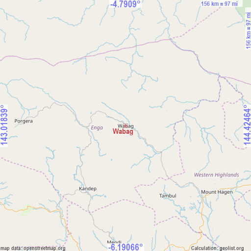
Wabag GPS coordinates[2]
5° 29' 28.284" South, 143° 43' 17.436" East
| Map corner | latitude | longitude |
|---|---|---|
| Upper-left | -4.7909°, | 143.01839° |
| Center: | -5.49119°, | 143.72151° |
| Lower-right: | -6.19066°, | 144.42464° |
| Map W x H: | 155.6×155.6 km | = 96.7×96.7mi |
| max Lat: | -2.0341° ⇑29.5% North |
| Wabag: | -5.49119° |
| min Lat: | ⇓70.5% South -10.61038° |
| min Long | Wabag | max Long |
| 141.29061° | 143.72151° | 155.69147° |
| W 22.7%⇐ | ⇒77.3% E |
Elevation
Elevation of Wabag is 2069 m = 6788 ft, and this is 1488 m = 4882 ft above average elevation for this country.
| Max E: |
2248 m = 7375 ft | 2.3% |
| Wabag | 2069 m 6788 ft | |
| Avg. | 581 m = 1906 ft | |
Min E: |
0 m = 0 ft | 97.7% |
See also: Papua New Guinea elevation on elevation.city.
Geographical zone
Wabag is located in South Torrid zone (between Equator and Tropic of Capricorn). Distance of Equator is 610.6 km =379.4 mi to North.| Distance of | km | miles | from Wabag |
|---|---|---|---|
| Equator | 610.6 | 379.4 | to North |
| Tropic Capricorn | 1995.4 | 1239.9 | to South |
| Antarctic Circle | 6790.6 | 4219.5 | to South |
| South Pole | 9396.5 | 5838.7 | to South |


Nearby cities:
15 places around Wabag: (largest is in red/bold)
• Ambunti
173.4 km =107.7 mi,  324°
324°
• Angoram
163.4 km =101.5 mi,  13°
13°
• Goroka
195.7 km =121.6 mi,  109°
109°
• Ialibu
92.9 km =57.7 mi,  161°
161°
• Kundiawa
150 km =93.2 mi, 113°
• Kurumul
108.5 km =67.4 mi, 111°
• Laiagam
19.4 km =12.1 mi,  23°
23°
• Madang
230.6 km =143.3 mi,  82°
82°
• Mendi
73.3 km =45.5 mi,  185°
185°
• Minj
116.9 km =72.6 mi, 113°
• Mount Hagen
69.5 km =43.2 mi,  125°
125°
• Porgera
63.6 km =39.5 mi,  272°
272°
• Rauna
68.4 km =42.5 mi, 113°
• Tari
94.3 km =58.6 mi,  245°
245°
• Wewak
216.1 km =134.3 mi,  357°
357°
Sources, notices
• [Note1] Compared only with cities in Papua New Guinea existing in our database
• [Src1] Map data: © OpenStreetMap contributors (CC-BY-SA)
• [Src2] Other city data from geonames.org with taken over terms of usage.
• [Src3] Geographical zone / Annual Mean Temperature by Robert A. Rohde @ Wikipedia
