Porgera geodata
Porgera (Enga) is a populated place; located in Papua New Guinea in Pacific/Port_Moresby (GMT+10) time zone. With population of 1,578 people, there are 34 cities with bigger population in this country. Compared to other cities in Papua New Guinea, 72.7% of cities are located further ↓South; 86.4% of cities are located further →East and 100% of cities have lower elevation than Porgera. Note1


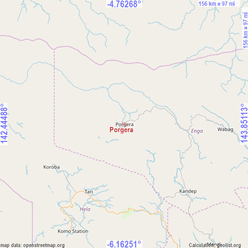
Porgera GPS coordinates[2]
5° 27' 46.8" South, 143° 8' 52.8" East
| Map corner | latitude | longitude |
|---|---|---|
| Upper-left | -4.76268°, | 142.44488° |
| Center: | -5.463°, | 143.148° |
| Lower-right: | -6.16251°, | 143.85113° |
| Map W x H: | 155.6×155.7 km | = 96.7×96.7mi |
| max Lat: | -2.0341° ⇑27.3% North |
| Porgera: | -5.463° |
| min Lat: | ⇓72.7% South -10.61038° |
| min Long | Porgera | max Long |
| 141.29061° | 143.148° | 155.69147° |
| W 13.6%⇐ | ⇒86.4% E |
Elevation
Elevation of Porgera is 2248 m = 7375 ft, and this is 1667 m = 5469 ft above average elevation for this country.
| Max E: |
2248 m = 7375 ft | 0% |
| Porgera | 2248 m 7375 ft | |
| Avg. | 581 m = 1906 ft | |
Min E: |
0 m = 0 ft | 100% |
See also: Papua New Guinea elevation on elevation.city.
Geographical zone
Porgera is located in South Torrid zone (between Equator and Tropic of Capricorn). Distance of Equator is 607.4 km =377.4 mi to North.| Distance of | km | miles | from Porgera |
|---|---|---|---|
| Equator | 607.4 | 377.4 | to North |
| Tropic Capricorn | 1998.5 | 1241.8 | to South |
| Antarctic Circle | 6793.7 | 4221.4 | to South |
| South Pole | 9399.6 | 5840.6 | to South |


Nearby cities:
15 places around Porgera: (largest is in red/bold)
• Ambunti
143.3 km =89 mi,  345°
345°
• Angoram
186 km =115.6 mi,  33°
33°
• Goroka
257.1 km =159.8 mi,  105°
105°
• Ialibu
130.5 km =81.1 mi,  134°
134°
• Kiunga
218.1 km =135.5 mi,  250°
250°
• Kundiawa
210.8 km =131 mi, 107°
• Kurumul
169.8 km =105.5 mi,  104°
104°
• Laiagam
72.6 km =45.1 mi,  78°
78°
• Mendi
94.6 km =58.8 mi,  143°
143°
• Minj
177.8 km =110.5 mi, 106°
• Mount Hagen
127.6 km =79.3 mi, 110°
• Rauna
129.8 km =80.7 mi, 103°
• Tari
48 km =29.8 mi,  207°
207°
• Wabag
63.6 km =39.5 mi,  92°
92°
• Wewak
219.4 km =136.3 mi,  14°
14°
Sources, notices
• [Note1] Compared only with cities in Papua New Guinea existing in our database
• [Src1] Map data: © OpenStreetMap contributors (CC-BY-SA)
• [Src2] Other city data from geonames.org with taken over terms of usage.
• [Src3] Geographical zone / Annual Mean Temperature by Robert A. Rohde @ Wikipedia
