Kiunga geodata
Kiunga (Western Province) is a populated place; located in Papua New Guinea in Pacific/Port_Moresby (GMT+10) time zone. With population of 11,536 people, there are 15 cities with bigger population in this country. Compared to other cities in Papua New Guinea, 50% of cities are located further ↓South; 100% of cities are located further →East and 50% of cities have lower elevation than Kiunga. Note1


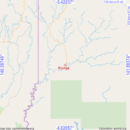
Kiunga GPS coordinates[2]
6° 7' 18.948" South, 141° 17' 26.196" East
| Map corner | latitude | longitude |
|---|---|---|
| Upper-left | -5.42237°, | 140.58749° |
| Center: | -6.12193°, | 141.29061° |
| Lower-right: | -6.82057°, | 141.99374° |
| Map W x H: | 155.5×155.5 km | = 96.6×96.6mi |
| max Lat: | -2.0341° ⇑50% North |
| Kiunga: | -6.12193° |
| min Lat: | ⇓50% South -10.61038° |
| min Long | Kiunga | max Long |
| 141.29061° | 141.29061° | 155.69147° |
| W 0%⇐ | ⇒100% E |
Elevation
Elevation of Kiunga is 40 m = 131 ft, and this is 541 m = 1775 ft below average elevation for this country.
| Max E: |
2248 m = 7375 ft | 50% |
| Avg. | 581 m = 1906 ft | |
| Kiunga | 40 m = 131 ft | |
Min E: |
0 m = 0 ft | 50% |
See also: Papua New Guinea elevation on elevation.city.
Geographical zone
Kiunga is located in South Torrid zone (between Equator and Tropic of Capricorn). Distance of Equator is 680.7 km =423 mi to North.| Distance of | km | miles | from Kiunga |
|---|---|---|---|
| Equator | 680.7 | 423 | to North |
| Tropic Capricorn | 1925.2 | 1196.3 | to South |
| Antarctic Circle | 6720.5 | 4175.9 | to South |
| South Pole | 9326.4 | 5795.2 | to South |


Nearby cities:
15 places around Kiunga: (largest is in red/bold)
• Aitape
352 km =218.7 mi,  19°
19°
• Ambunti
271.1 km =168.5 mi,  38°
38°
• Angoram
383.3 km =238.2 mi,  53°
53°
• Ialibu
299.3 km =186 mi,  93°
93°
• Kurumul
370.6 km =230.3 mi, 85°
• Laiagam
290.2 km =180.3 mi,  72°
72°
• Mendi
261.6 km =162.6 mi, 90°
• Minj
376.8 km =234.1 mi, 86°
• Morehead
290.4 km =180.4 mi,  172°
172°
• Mount Hagen
326.4 km =202.8 mi,  84°
84°
• Porgera
218.1 km =135.5 mi, 70°
• Rauna
334.3 km =207.7 mi, 82°
• Tari
185.7 km =115.4 mi, 80°
• Vanimo
382.3 km =237.6 mi,  0°
0°
• Wabag
277.9 km =172.7 mi, 75°
Sources, notices
• [Note1] Compared only with cities in Papua New Guinea existing in our database
• [Src1] Map data: © OpenStreetMap contributors (CC-BY-SA)
• [Src2] Other city data from geonames.org with taken over terms of usage.
• [Src3] Geographical zone / Annual Mean Temperature by Robert A. Rohde @ Wikipedia
