Lae geodata
Lae (Morobe) is a seat of a first-order administrative division; located in Papua New Guinea in Pacific/Port_Moresby (GMT+10) time zone. With population of 76,255 people, there is 1 city with bigger population in this country. Compared to other cities in Papua New Guinea, 70.5% of cities are located further ↑North; 59.1% of cities are located further ←West and 61.4% of cities have higher elevation than Lae. Note1


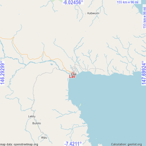
Lae GPS coordinates[2]
6° 43' 23.988" South, 146° 59' 45.996" East
| Map corner | latitude | longitude |
|---|---|---|
| Upper-left | -6.02456°, | 146.29299° |
| Center: | -6.72333°, | 146.99611° |
| Lower-right: | -7.4211°, | 147.69924° |
| Map W x H: | 155.3×155.3 km | = 96.5×96.5mi |
| max Lat: | -2.0341° ⇑70.5% North |
| Lae: | -6.72333° |
| min Lat: | ⇓29.5% South -10.61038° |
| min Long | Lae | max Long |
| 141.29061° | 146.99611° | 155.69147° |
| W 59.1%⇐ | ⇒40.9% E |
Elevation
Elevation of Lae is 20 m = 66 ft, and this is 561 m = 1841 ft below average elevation for this country.
| Max E: |
2248 m = 7375 ft | 61.4% |
| Avg. | 581 m = 1906 ft | |
| Lae | 20 m = 66 ft | |
Min E: |
0 m = 0 ft | 38.6% |
See also: Lae elevation on elevation.city.
Geographical zone
Lae is located in South Torrid zone (between Equator and Tropic of Capricorn). Distance of Equator is 747.6 km =464.5 mi to North.| Distance of | km | miles | from Lae |
|---|---|---|---|
| Equator | 747.6 | 464.5 | to North |
| Tropic Capricorn | 1858.4 | 1154.8 | to South |
| Antarctic Circle | 6653.6 | 4134.4 | to South |
| South Pole | 9259.5 | 5753.6 | to South |


Nearby cities:
15 places around Lae: (largest is in red/bold)
• Bulolo
66.3 km =41.2 mi,  216°
216°
• Finschhafen
95.7 km =59.5 mi,  78°
78°
• Goroka
191.5 km =119 mi,  291°
291°
• Ihu
219.6 km =136.5 mi,  233°
233°
• Kainantu
133.9 km =83.2 mi, 291°
• Kandrian
287.7 km =178.8 mi, 78°
• Kerema
192.7 km =119.7 mi, 224°
• Kokoda
253.1 km =157.3 mi,  161°
161°
• Kundiawa
237.3 km =147.5 mi, 289°
• Kurumul
278.6 km =173.1 mi, 290°
• Madang
213.9 km =132.9 mi,  321°
321°
• Minj
270.4 km =168 mi, 289°
• Popondetta
264.8 km =164.5 mi,  149°
149°
• Port Moresby
306.7 km =190.6 mi,  176°
176°
• Wau
75 km =46.6 mi,  204°
204°
Sources, notices
• [Note1] Compared only with cities in Papua New Guinea existing in our database
• [Src1] Map data: © OpenStreetMap contributors (CC-BY-SA)
• [Src2] Other city data from geonames.org with taken over terms of usage.
• [Src3] Geographical zone / Annual Mean Temperature by Robert A. Rohde @ Wikipedia
