Ihu geodata
Ihu (Gulf) is a seat of a third-order administrative division; located in Papua New Guinea in Pacific/Port_Moresby (GMT+10) time zone. In our database, there are 39 cities with bigger population. Compared to other cities in Papua New Guinea, 79.5% of cities are located further ↑North; 54.5% of cities are located further →East and 72.7% of cities have higher elevation than Ihu. Note1


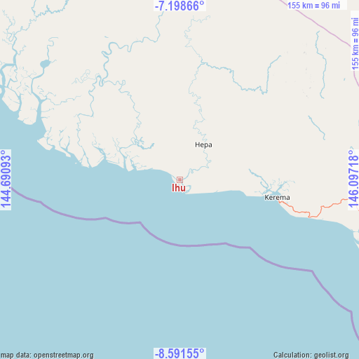
Ihu GPS coordinates[2]
7° 53' 44.484" South, 145° 23' 38.58" East
| Map corner | latitude | longitude |
|---|---|---|
| Upper-left | -7.19866°, | 144.69093° |
| Center: | -7.89569°, | 145.39405° |
| Lower-right: | -8.59155°, | 146.09718° |
| Map W x H: | 154.9×154.9 km | = 96.3×96.3mi |
| max Lat: | -2.0341° ⇑79.5% North |
| Ihu: | -7.89569° |
| min Lat: | ⇓20.5% South -10.61038° |
| min Long | Ihu | max Long |
| 141.29061° | 145.39405° | 155.69147° |
| W 45.5%⇐ | ⇒54.5% E |
Elevation
Elevation of Ihu is 11 m = 36 ft, and this is 570 m = 1870 ft below average elevation for this country.
| Max E: |
2248 m = 7375 ft | 72.7% |
| Avg. | 581 m = 1906 ft | |
| Ihu | 11 m = 36 ft | |
Min E: |
0 m = 0 ft | 27.3% |
See also: Papua New Guinea elevation on elevation.city.
Geographical zone
Ihu is located in South Torrid zone (between Equator and Tropic of Capricorn). Distance of Equator is 877.9 km =545.5 mi to North.| Distance of | km | miles | from Ihu |
|---|---|---|---|
| Equator | 877.9 | 545.5 | to North |
| Tropic Capricorn | 1728 | 1073.7 | to South |
| Antarctic Circle | 6523.3 | 4053.4 | to South |
| South Pole | 9129.1 | 5672.6 | to South |


Nearby cities:
15 places around Ihu: (largest is in red/bold)
• Bulolo
157.4 km =97.8 mi,  60°
60°
• Daru
273.9 km =170.2 mi,  241°
241°
• Goroka
201.3 km =125.1 mi,  359°
359°
• Ialibu
236.8 km =147.1 mi,  319°
319°
• Kainantu
186.1 km =115.6 mi,  16°
16°
• Kerema
42.3 km =26.3 mi,  99°
99°
• Kundiawa
213.8 km =132.8 mi,  347°
347°
• Kurumul
242 km =150.4 mi,  339°
339°
• Lae
219.6 km =136.5 mi,  53°
53°
• Mendi
273 km =169.6 mi, 315°
• Minj
234.3 km =145.6 mi, 340°
• Mount Hagen
260.5 km =161.9 mi,  330°
330°
• Port Moresby
261.2 km =162.3 mi,  132°
132°
• Rauna
269.4 km =167.4 mi, 333°
• Wau
158.4 km =98.4 mi,  66°
66°
Sources, notices
• [Note1] Compared only with cities in Papua New Guinea existing in our database
• [Src1] Map data: © OpenStreetMap contributors (CC-BY-SA)
• [Src2] Other city data from geonames.org with taken over terms of usage.
• [Src3] Geographical zone / Annual Mean Temperature by Robert A. Rohde @ Wikipedia
