Janikowo geodata
Janikowo (Warmia-Masuria) is a populated place; located in Poland in Europe/Warsaw (GMT+2) time zone. With population of 540 people, there are 3429 cities with bigger population in this country. Compared to other cities in Poland, 96.6% of cities are located further ↓South; 64.5% of cities are located further ←West and 51.3% of cities have higher elevation than Janikowo. Note1
Administrative division(s):
- Level 1: Warmia-Masuria
- Level 2: Powiat bartoszycki
- Level 3: Górowo Iławeckie


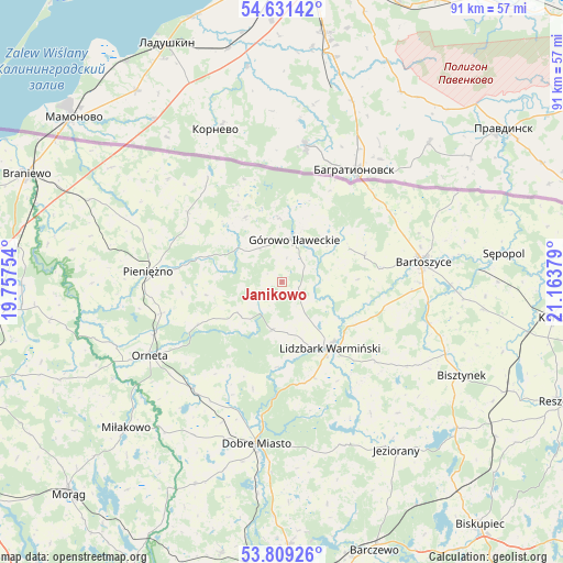
Janikowo GPS coordinates[2]
54° 13' 20.604" North, 20° 27' 38.376" East
| Map corner | latitude | longitude |
|---|---|---|
| Upper-left | 54.63142°, | 19.75754° |
| Center: | 54.22239°, | 20.46066° |
| Lower-right: | 53.80926°, | 21.16379° |
| Map W x H: | 91.4×91.4 km | = 56.8×56.8mi |
| max Lat: | 54.83135° ⇑3.4% North |
| Janikowo: | 54.22239° |
| min Lat: | ⇓96.6% South 49.21328° |
| min Long | Janikowo | max Long |
| 14.20249° | 20.46066° | 24.03723° |
| W 64.5%⇐ | ⇒35.5% E |
Elevation
Elevation of Janikowo is 169 m = 554 ft, and this is 22.4 m = 73 ft below average elevation for this country.
| Max E: |
974 m = 3196 ft | 51.3% |
| Avg. | 191.4 m = 628 ft | |
| Janikowo | 169 m = 554 ft | |
Min E: |
-3 m = -10 ft | 48.7% |
See also: Poland elevation on elevation.city.
Geographical zone
Janikowo is located in North temperate zone (between Tropic of Cancer and the Arctic Circle). Distance of this North polar circle is 1372.2 km =852.6 mi to North.| Distance of | km | miles | from Janikowo |
|---|---|---|---|
| North Pole | 3978.1 | 2471.9 | to North |
| Arctic Circle | 1372.2 | 852.6 | to North |
| Tropic Cancer | 3423 | 2127 | to South |
| Equator | 6029 | 3746.2 | to South |


Nearby cities:
15 places around Janikowo: (largest is in red/bold)
• Bartoszyce
22.8 km =14.2 mi,  81°
81°
• Bisztynek
32.5 km =20.2 mi,  117°
117°
• Dobre Miasto
26.5 km =16.5 mi,  188°
188°
• Dywity
42.8 km =26.6 mi,  178°
178°
• Górowo Iławeckie
7.3 km =4.5 mi,  14°
14°
• Jeziorany
33.2 km =20.6 mi,  145°
145°
• Lelkowo
19.1 km =11.9 mi,  306°
306°
• Lidzbark Warmiński
13.2 km =8.2 mi,  144°
144°
• Lubomino
22.5 km =14 mi,  219°
219°
• Miłakowo
34.7 km =21.6 mi,  226°
226°
• Orneta
24.4 km =15.2 mi,  240°
240°
• Pieniężno
21.7 km =13.5 mi,  274°
274°
• Spręcowo
38.1 km =23.7 mi, 182°
• Sępopol
36.4 km =22.6 mi, 81°
• Świątki
35.8 km =22.2 mi,  203°
203°
Sources, notices
• [Note1] Compared only with cities in Poland existing in our database
• [Src1] Map data: © OpenStreetMap contributors (CC-BY-SA)
• [Src2] Other city data from geonames.org with taken over terms of usage.
• [Src3] Geographical zone / Annual Mean Temperature by Robert A. Rohde @ Wikipedia
