Bisztynek geodata
Bisztynek (Warmia-Masuria) is a seat of a third-order administrative division; located in Poland in Europe/Warsaw (GMT+2) time zone. With population of 2,462 people, there are 1266 cities with bigger population in this country. Compared to other cities in Poland, 95.1% of cities are located further ↓South; 70.8% of cities are located further ←West and 67.1% of cities have higher elevation than Bisztynek. Note1


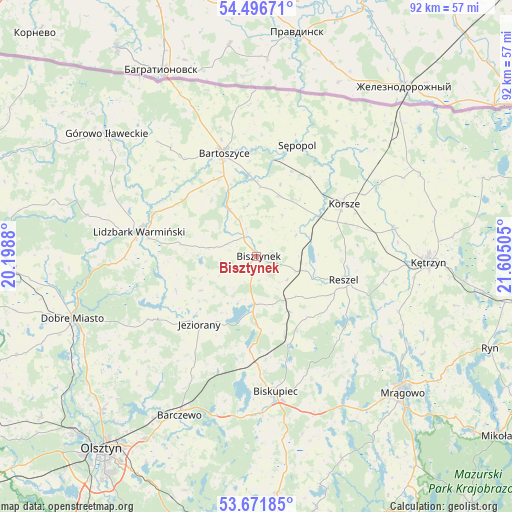
Bisztynek GPS coordinates[2]
54° 5' 10.788" North, 20° 54' 6.912" East
| Map corner | latitude | longitude |
|---|---|---|
| Upper-left | 54.49671°, | 20.1988° |
| Center: | 54.08633°, | 20.90192° |
| Lower-right: | 53.67185°, | 21.60505° |
| Map W x H: | 91.7×91.7 km | = 57×57mi |
| max Lat: | 54.83135° ⇑4.9% North |
| Bisztynek: | 54.08633° |
| min Lat: | ⇓95.1% South 49.21328° |
| min Long | Bisztynek | max Long |
| 14.20249° | 20.90192° | 24.03723° |
| W 70.8%⇐ | ⇒29.2% E |
Elevation
Elevation of Bisztynek is 128 m = 420 ft, and this is 63.4 m = 208 ft below average elevation for this country.
| Max E: |
974 m = 3196 ft | 67.1% |
| Avg. | 191.4 m = 628 ft | |
| Bisztynek | 128 m = 420 ft | |
Min E: |
-3 m = -10 ft | 32.9% |
See also: Poland elevation on elevation.city.
Geographical zone
Bisztynek is located in North temperate zone (between Tropic of Cancer and the Arctic Circle). Distance of this North polar circle is 1387.3 km =862 mi to North.| Distance of | km | miles | from Bisztynek |
|---|---|---|---|
| North Pole | 3993.2 | 2481.3 | to North |
| Arctic Circle | 1387.3 | 862 | to North |
| Tropic Cancer | 3407.9 | 2117.6 | to South |
| Equator | 6013.8 | 3736.8 | to South |


Nearby cities:
15 places around Bisztynek: (largest is in red/bold)
• Barciany
32.9 km =20.4 mi,  63°
63°
• Barczewo
31.6 km =19.6 mi,  205°
205°
• Bartoszyce
19.6 km =12.2 mi,  341°
341°
• Biskupiec
24.9 km =15.5 mi,  171°
171°
• Czerwonka
18.9 km =11.7 mi,  181°
181°
• Dobre Miasto
34.8 km =21.6 mi,  251°
251°
• Janikowo
32.5 km =20.2 mi,  297°
297°
• Jeziorany
15.9 km =9.9 mi,  219°
219°
• Kolno
11.6 km =7.2 mi,  148°
148°
• Korsze
18 km =11.2 mi, 58°
• Kętrzyn
30.9 km =19.2 mi,  91°
91°
• Lidzbark Warmiński
21.5 km =13.4 mi,  281°
281°
• Reszel
16.4 km =10.2 mi,  104°
104°
• Sorkwity
31 km =19.3 mi, 149°
• Sępopol
21.6 km =13.4 mi,  19°
19°
Sources, notices
• [Note1] Compared only with cities in Poland existing in our database
• [Src1] Map data: © OpenStreetMap contributors (CC-BY-SA)
• [Src2] Other city data from geonames.org with taken over terms of usage.
• [Src3] Geographical zone / Annual Mean Temperature by Robert A. Rohde @ Wikipedia
