Bartoszyce geodata
Bartoszyce (Warmia-Masuria) is a populated place; located in Poland in Europe/Warsaw (GMT+2) time zone. With population of 25,660 people, there are 192 cities with bigger population in this country. Compared to other cities in Poland, 97.1% of cities are located further ↓South; 69.3% of cities are located further ←West and 95% of cities have higher elevation than Bartoszyce. Note1


Bartoszyce GPS coordinates[2]
54° 15' 12.744" North, 20° 48' 29.484" East
| Map corner | latitude | longitude |
|---|---|---|
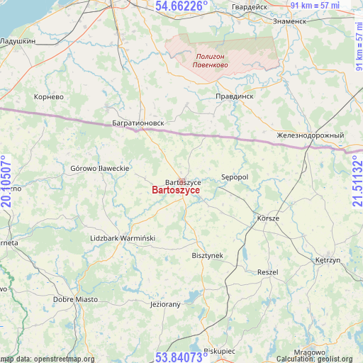
| Upper-left | 54.66226°, | 20.10507° |
| Center: | 54.25354°, | 20.80819° |
| Lower-right: | 53.84073°, | 21.51132° |
| Map W x H: | 91.3×91.3 km | = 56.7×56.7mi |
| max Lat: | 54.83135° ⇑2.9% North |
| Bartoszyce: | 54.25354° |
| min Lat: | ⇓97.1% South 49.21328° |
| min Long | Bartoszyce | max Long |
| 14.20249° | 20.80819° | 24.03723° |
| W 69.3%⇐ | ⇒30.7% E |
Elevation
Elevation of Bartoszyce is 41 m = 135 ft, and this is 150.4 m = 493 ft below average elevation for this country.
| Max E: |
974 m = 3196 ft | 95% |
| Avg. | 191.4 m = 628 ft | |
| Bartoszyce | 41 m = 135 ft | |
Min E: |
-3 m = -10 ft | 5% |
See also: Poland elevation on elevation.city.
Geographical zone
Bartoszyce is located in North temperate zone (between Tropic of Cancer and the Arctic Circle). Distance of this North polar circle is 1368.7 km =850.5 mi to North.| Distance of | km | miles | from Bartoszyce |
|---|---|---|---|
| North Pole | 3974.6 | 2469.7 | to North |
| Arctic Circle | 1368.7 | 850.5 | to North |
| Tropic Cancer | 3426.5 | 2129.1 | to South |
| Equator | 6032.4 | 3748.4 | to South |


Nearby cities:
15 places around Bartoszyce: (largest is in red/bold)
• Barciany
35.6 km =22.1 mi,  96°
96°
• Bisztynek
19.6 km =12.2 mi,  161°
161°
• Czerwonka
37.9 km =23.5 mi,  171°
171°
• Dobre Miasto
40 km =24.9 mi,  222°
222°
• Górowo Iławeckie
21 km =13 mi,  279°
279°
• Janikowo
22.8 km =14.2 mi,  261°
261°
• Jeziorany
31.1 km =19.3 mi,  187°
187°
• Kolno
31 km =19.3 mi, 156°
• Korsze
23.4 km =14.5 mi,  113°
113°
• Kętrzyn
41.8 km =26 mi,  118°
118°
• Lelkowo
38.7 km =24 mi, 281°
• Lidzbark Warmiński
20.6 km =12.8 mi,  226°
226°
• Lubomino
42.4 km =26.3 mi,  240°
240°
• Reszel
31.5 km =19.6 mi,  135°
135°
• Sępopol
13.5 km =8.4 mi,  82°
82°
Sources, notices
• [Note1] Compared only with cities in Poland existing in our database
• [Src1] Map data: © OpenStreetMap contributors (CC-BY-SA)
• [Src2] Other city data from geonames.org with taken over terms of usage.
• [Src3] Geographical zone / Annual Mean Temperature by Robert A. Rohde @ Wikipedia
