Khamis Mushait geodata
Khamis Mushait ('Asir) is a populated place; located in Saudi Arabia in Asia/Riyadh (GMT+3) time zone. With population of 387,553 people, there are 10 cities with bigger population in this country. Compared to other cities in Saudi Arabia, 88.7% of cities are located further ↑North; 61.9% of cities are located further →East and 94.8% of cities have lower elevation than Khamis Mushait. Note1


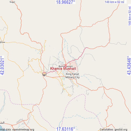
Khamis Mushait GPS coordinates[2]
18° 18' 0" North, 42° 43' 59.988" East
| Map corner | latitude | longitude |
|---|---|---|
| Upper-left | 18.96627°, | 42.03021° |
| Center: | 18.3°, | 42.73333° |
| Lower-right: | 17.63116°, | 43.43646° |
| Map W x H: | 148.5×148.5 km | = 92.3×92.3mi |
| max Lat: | 31.67252° ⇑88.7% North |
| Khamis Mushait: | 18.3° |
| min Lat: | ⇓11.3% South 16.57946° |
| min Long | Khamis Mushait | max Long |
| 35.69014° | 42.73333° | 54.09599° |
| W 38.1%⇐ | ⇒61.9% E |
Elevation
Elevation of Khamis Mushait is 1998 m = 6555 ft, and this is 1476.6 m = 4844 ft above average elevation for this country.
| Max E: |
2385 m = 7825 ft | 5.2% |
| Khamis Mushait | 1998 m 6555 ft | |
| Avg. | 521.4 m = 1711 ft | |
Min E: |
3 m = 10 ft | 94.8% |
See also: Khamis Mushait elevation on elevation.city.
Geographical zone
Khamis Mushait is located in North Torrid zone (between Equator and Tropic of Cancer). Distance of this Northern Tropic circle is 571.1 km =354.9 mi to North.| Distance of | km | miles | from Khamis Mushait |
|---|---|---|---|
| North Pole | 7972.3 | 4953.8 | to North |
| Arctic Circle | 5366.4 | 3334.5 | to North |
| Tropic Cancer | 571.1 | 354.9 | to North |
| Equator | 2034.8 | 1264.4 | to South |


Nearby cities:
15 places around Khamis Mushait: (largest is in red/bold)
• Abha
25.8 km =16 mi,  248°
248°
• Abū ‘Arīsh
148.4 km =92.2 mi,  175°
175°
• Ad Darb
81.9 km =50.9 mi,  218°
218°
• Al Jarādīyah
192.2 km =119.4 mi,  174°
174°
• Al Majāridah
126 km =78.3 mi,  316°
316°
• An Nimāş
114.1 km =70.9 mi,  325°
325°
• Farasān
189.2 km =117.6 mi,  200°
200°
• Jizan
158.1 km =98.2 mi,  187°
187°
• Mislīyah
95.3 km =59.2 mi, 191°
• Mizhirah
163.9 km =101.8 mi, 180°
• Najrān
172.7 km =107.3 mi,  121°
121°
• Qal‘at Bīshah
189.6 km =117.8 mi,  355°
355°
• Tabālah
186.8 km =116.1 mi,  349°
349°
• Şabyā
128.4 km =79.8 mi, 185°
• Şāmitah
190.8 km =118.6 mi, 173°
Sources, notices
• [Note1] Compared only with cities in Saudi Arabia existing in our database
• [Src1] Map data: © OpenStreetMap contributors (CC-BY-SA)
• [Src2] Other city data from geonames.org with taken over terms of usage.
• [Src3] Geographical zone / Annual Mean Temperature by Robert A. Rohde @ Wikipedia
