Jizan geodata
Jizan is a seat of a first-order administrative division; located in Saudi Arabia in Asia/Riyadh (GMT+3) time zone. With population of 105,198 people, there are 22 cities with bigger population in this country. Compared to other cities in Saudi Arabia, 95.9% of cities are located further ↑North; 66% of cities are located further →East and 82.5% of cities have higher elevation than Jizan. Note1


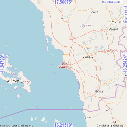
Jizan GPS coordinates[2]
16° 53' 21.012" North, 42° 33' 3.996" East
| Map corner | latitude | longitude |
|---|---|---|
| Upper-left | 17.56075°, | 41.84799° |
| Center: | 16.88917°, | 42.55111° |
| Lower-right: | 16.21519°, | 43.25424° |
| Map W x H: | 149.6×149.6 km | = 93×93mi |
| max Lat: | 31.67252° ⇑95.9% North |
| Jizan: | 16.88917° |
| min Lat: | ⇓4.1% South 16.57946° |
| min Long | Jizan | max Long |
| 35.69014° | 42.55111° | 54.09599° |
| W 34%⇐ | ⇒66% E |
Elevation
Elevation of Jizan is 19 m = 62 ft, and this is 502.4 m = 1648 ft below average elevation for this country.
| Max E: |
2385 m = 7825 ft | 82.5% |
| Avg. | 521.4 m = 1711 ft | |
| Jizan | 19 m = 62 ft | |
Min E: |
3 m = 10 ft | 17.5% |
See also: Jizan elevation on elevation.city.
Geographical zone
Jizan is located in North Torrid zone (between Equator and Tropic of Cancer). Distance of this Northern Tropic circle is 728 km =452.4 mi to North.| Distance of | km | miles | from Jizan |
|---|---|---|---|
| North Pole | 8129.2 | 5051.2 | to North |
| Arctic Circle | 5523.3 | 3432 | to North |
| Tropic Cancer | 728 | 452.4 | to North |
| Equator | 1877.9 | 1166.9 | to South |


Nearby cities:
15 places around Jizan: (largest is in red/bold)
• Abha
147.7 km =91.8 mi,  358°
358°
• Abū ‘Arīsh
31.2 km =19.4 mi,  73°
73°
• Ad Darb
98 km =60.9 mi,  341°
341°
• Al Jarādīyah
51.6 km =32.1 mi,  131°
131°
• Al Majāridah
257.5 km =160 mi, 344°
• An Nimāş
255 km =158.4 mi,  349°
349°
• Farasān
50.5 km =31.4 mi,  245°
245°
• Khamis Mushait
158.1 km =98.2 mi,  7°
7°
• Mislīyah
63.5 km =39.5 mi,  0°
0°
• Mizhirah
20.6 km =12.8 mi,  109°
109°
• Najrān
180.4 km =112.1 mi, 68°
• Qal‘at Bīshah
346 km =215 mi, 0°
• Tabālah
340.7 km =211.7 mi, 357°
• Şabyā
30 km =18.6 mi,  15°
15°
• Şāmitah
53.1 km =33 mi, 127°
Sources, notices
• [Note1] Compared only with cities in Saudi Arabia existing in our database
• [Src1] Map data: © OpenStreetMap contributors (CC-BY-SA)
• [Src2] Other city data from geonames.org with taken over terms of usage.
• [Src3] Geographical zone / Annual Mean Temperature by Robert A. Rohde @ Wikipedia
