Abha geodata
Abha ('Asir) is a seat of a first-order administrative division; located in Saudi Arabia in Asia/Riyadh (GMT+3) time zone. With population of 210,886 people, there are 17 cities with bigger population in this country. Compared to other cities in Saudi Arabia, 89.7% of cities are located further ↑North; 67% of cities are located further →East and 97.9% of cities have lower elevation than Abha. Note1


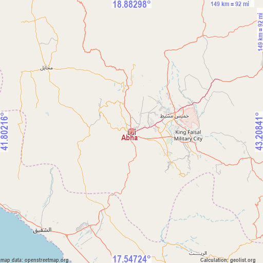
Abha GPS coordinates[2]
18° 12' 59.004" North, 42° 30' 19.008" East
| Map corner | latitude | longitude |
|---|---|---|
| Upper-left | 18.88298°, | 41.80216° |
| Center: | 18.21639°, | 42.50528° |
| Lower-right: | 17.54724°, | 43.20841° |
| Map W x H: | 148.5×148.5 km | = 92.3×92.3mi |
| max Lat: | 31.67252° ⇑89.7% North |
| Abha: | 18.21639° |
| min Lat: | ⇓10.3% South 16.57946° |
| min Long | Abha | max Long |
| 35.69014° | 42.50528° | 54.09599° |
| W 33%⇐ | ⇒67% E |
Elevation
Elevation of Abha is 2228 m = 7310 ft, and this is 1706.6 m = 5599 ft above average elevation for this country.
| Max E: |
2385 m = 7825 ft | 2.1% |
| Abha | 2228 m 7310 ft | |
| Avg. | 521.4 m = 1711 ft | |
Min E: |
3 m = 10 ft | 97.9% |
See also: Abha elevation on elevation.city.
Geographical zone
Abha is located in North Torrid zone (between Equator and Tropic of Cancer). Distance of this Northern Tropic circle is 580.4 km =360.6 mi to North.| Distance of | km | miles | from Abha |
|---|---|---|---|
| North Pole | 7981.6 | 4959.5 | to North |
| Arctic Circle | 5375.7 | 3340.3 | to North |
| Tropic Cancer | 580.4 | 360.6 | to North |
| Equator | 2025.5 | 1258.6 | to South |


Nearby cities:
15 places around Abha: (largest is in red/bold)
• Abū ‘Arīsh
143 km =88.9 mi,  165°
165°
• Ad Darb
61 km =37.9 mi,  205°
205°
• Al Jarādīyah
187.1 km =116.3 mi, 166°
• Al Majāridah
118.7 km =73.8 mi,  328°
328°
• An Nimāş
111 km =69 mi,  338°
338°
• Farasān
173.3 km =107.7 mi,  193°
193°
• Jizan
147.7 km =91.8 mi,  178°
178°
• Khamis Mushait
25.8 km =16 mi,  68°
68°
• Mislīyah
84.3 km =52.4 mi, 176°
• Mizhirah
156.5 km =97.2 mi, 171°
• Najrān
189.6 km =117.8 mi,  115°
115°
• Qal‘at Bīshah
198.7 km =123.5 mi,  3°
3°
• Tabālah
193.1 km =120 mi,  356°
356°
• Şabyā
119.3 km =74.1 mi, 173°
• Şāmitah
186.1 km =115.6 mi, 165°
Sources, notices
• [Note1] Compared only with cities in Saudi Arabia existing in our database
• [Src1] Map data: © OpenStreetMap contributors (CC-BY-SA)
• [Src2] Other city data from geonames.org with taken over terms of usage.
• [Src3] Geographical zone / Annual Mean Temperature by Robert A. Rohde @ Wikipedia
