Farasān geodata
Farasān (Jizan) is a populated place; located in Saudi Arabia in Asia/Riyadh (GMT+3) time zone. With population of 10,527 people, there are 68 cities with bigger population in this country. Compared to other cities in Saudi Arabia, 97.9% of cities are located further ↑North; 71.1% of cities are located further →East and 78.4% of cities have higher elevation than Farasān. Note1


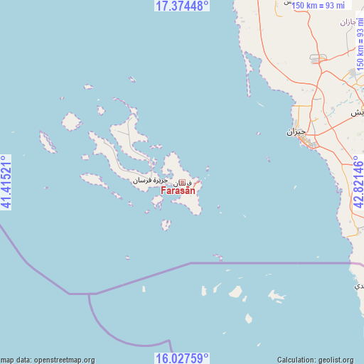
Farasān GPS coordinates[2]
16° 42' 7.992" North, 42° 7' 5.988" East
| Map corner | latitude | longitude |
|---|---|---|
| Upper-left | 17.37448°, | 41.41521° |
| Center: | 16.70222°, | 42.11833° |
| Lower-right: | 16.02759°, | 42.82146° |
| Map W x H: | 149.8×149.8 km | = 93.1×93.1mi |
| max Lat: | 31.67252° ⇑97.9% North |
| Farasān: | 16.70222° |
| min Lat: | ⇓2.1% South 16.57946° |
| min Long | Farasān | max Long |
| 35.69014° | 42.11833° | 54.09599° |
| W 28.9%⇐ | ⇒71.1% E |
Elevation
Elevation of Farasān is 22 m = 72 ft, and this is 499.4 m = 1638 ft below average elevation for this country.
| Max E: |
2385 m = 7825 ft | 78.4% |
| Avg. | 521.4 m = 1711 ft | |
| Farasān | 22 m = 72 ft | |
Min E: |
3 m = 10 ft | 21.6% |
See also: Saudi Arabia elevation on elevation.city.
Geographical zone
Farasān is located in North Torrid zone (between Equator and Tropic of Cancer). Distance of this Northern Tropic circle is 748.8 km =465.3 mi to North.| Distance of | km | miles | from Farasān |
|---|---|---|---|
| North Pole | 8149.9 | 5064.1 | to North |
| Arctic Circle | 5544.1 | 3444.9 | to North |
| Tropic Cancer | 748.8 | 465.3 | to North |
| Equator | 1857.1 | 1153.9 | to South |


Nearby cities:
15 places around Farasān: (largest is in red/bold)
• Abha
173.3 km =107.7 mi,  13°
13°
• Abū ‘Arīsh
81.6 km =50.7 mi,  68°
68°
• Ad Darb
114.4 km =71.1 mi, 7°
• Al Jarādīyah
85.7 km =53.3 mi,  99°
99°
• Al Majāridah
270.1 km =167.8 mi,  355°
355°
• An Nimāş
271.7 km =168.8 mi,  0°
0°
• Jizan
50.5 km =31.4 mi, 65°
• Khamis Mushait
189.2 km =117.6 mi,  20°
20°
• Mislīyah
96.3 km =59.8 mi,  28°
28°
• Mizhirah
66.9 km =41.6 mi,  78°
78°
• Najrān
230.9 km =143.5 mi, 67°
• Qal‘at Bīshah
370.3 km =230.1 mi, 7°
• Tabālah
362.3 km =225.1 mi, 4°
• Şabyā
73.4 km =45.6 mi,  47°
47°
• Şāmitah
88.8 km =55.2 mi, 97°
Sources, notices
• [Note1] Compared only with cities in Saudi Arabia existing in our database
• [Src1] Map data: © OpenStreetMap contributors (CC-BY-SA)
• [Src2] Other city data from geonames.org with taken over terms of usage.
• [Src3] Geographical zone / Annual Mean Temperature by Robert A. Rohde @ Wikipedia
