Qal‘at Bīshah geodata
Qal‘at Bīshah ('Asir) is a populated place; located in Saudi Arabia in Asia/Riyadh (GMT+3) time zone. With population of 81,828 people, there are 28 cities with bigger population in this country. Compared to other cities in Saudi Arabia, 84.5% of cities are located further ↑North; 63.9% of cities are located further →East and 89.7% of cities have lower elevation than Qal‘at Bīshah. Note1


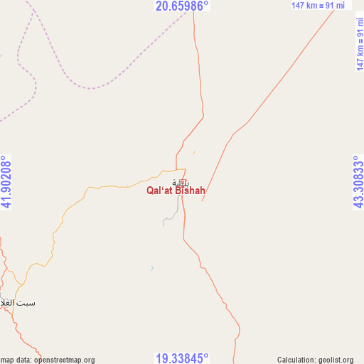
Qal‘at Bīshah GPS coordinates[2]
20° 0' 1.944" North, 42° 36' 18.72" East
| Map corner | latitude | longitude |
|---|---|---|
| Upper-left | 20.65986°, | 41.90208° |
| Center: | 20.00054°, | 42.6052° |
| Lower-right: | 19.33845°, | 43.30833° |
| Map W x H: | 146.9×146.9 km | = 91.3×91.3mi |
| max Lat: | 31.67252° ⇑84.5% North |
| Qal‘at Bīshah: | 20.00054° |
| min Lat: | ⇓15.5% South 16.57946° |
| min Long | Qal‘at Bīsha | max Long |
| 35.69014° | 42.6052° | 54.09599° |
| W 36.1%⇐ | ⇒63.9% E |
Elevation
Elevation of Qal‘at Bīshah is 1168 m = 3832 ft, and this is 646.6 m = 2121 ft above average elevation for this country.
| Max E: |
2385 m = 7825 ft | 10.3% |
| Qal‘at Bīshah | 1168 m 3832 ft | |
| Avg. | 521.4 m = 1711 ft | |
Min E: |
3 m = 10 ft | 89.7% |
See also: Qal‘at Bīshah elevation on elevation.city.
Geographical zone
Qal‘at Bīshah is located in North Torrid zone (between Equator and Tropic of Cancer). Distance of this Northern Tropic circle is 382.1 km =237.4 mi to North.| Distance of | km | miles | from Qal‘at Bīshah |
|---|---|---|---|
| North Pole | 7783.2 | 4836.3 | to North |
| Arctic Circle | 5177.3 | 3217 | to North |
| Tropic Cancer | 382.1 | 237.4 | to North |
| Equator | 2223.9 | 1381.9 | to South |


Nearby cities:
15 places around Qal‘at Bīshah: (largest is in red/bold)
• Abha
198.7 km =123.5 mi,  183°
183°
• Ad Darb
256 km =159.1 mi,  188°
188°
• Al Bahah
118.9 km =73.9 mi,  270°
270°
• Al Hadā
285 km =177.1 mi,  302°
302°
• Al Majāridah
121.6 km =75.6 mi,  216°
216°
• Al Mindak
139.2 km =86.5 mi,  277°
277°
• Al Muwayh
284.4 km =176.7 mi,  342°
342°
• An Nimāş
107.8 km =67 mi,  208°
208°
• As Sulayyil
314.3 km =195.3 mi,  80°
80°
• Ash Shafā
266.9 km =165.8 mi, 296°
• Khamis Mushait
189.6 km =117.8 mi, 175°
• Mislīyah
282.5 km =175.5 mi, 181°
• Tabālah
22.2 km =13.8 mi,  255°
255°
• Ta’if
268 km =166.5 mi, 301°
• Turabah
168.6 km =104.8 mi,  323°
323°
Sources, notices
• [Note1] Compared only with cities in Saudi Arabia existing in our database
• [Src1] Map data: © OpenStreetMap contributors (CC-BY-SA)
• [Src2] Other city data from geonames.org with taken over terms of usage.
• [Src3] Geographical zone / Annual Mean Temperature by Robert A. Rohde @ Wikipedia
